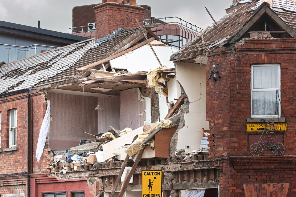
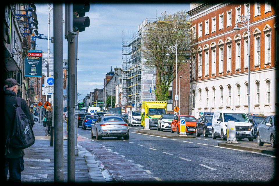
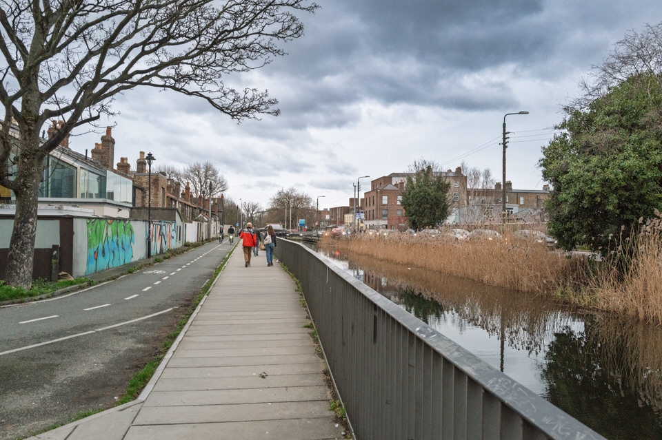
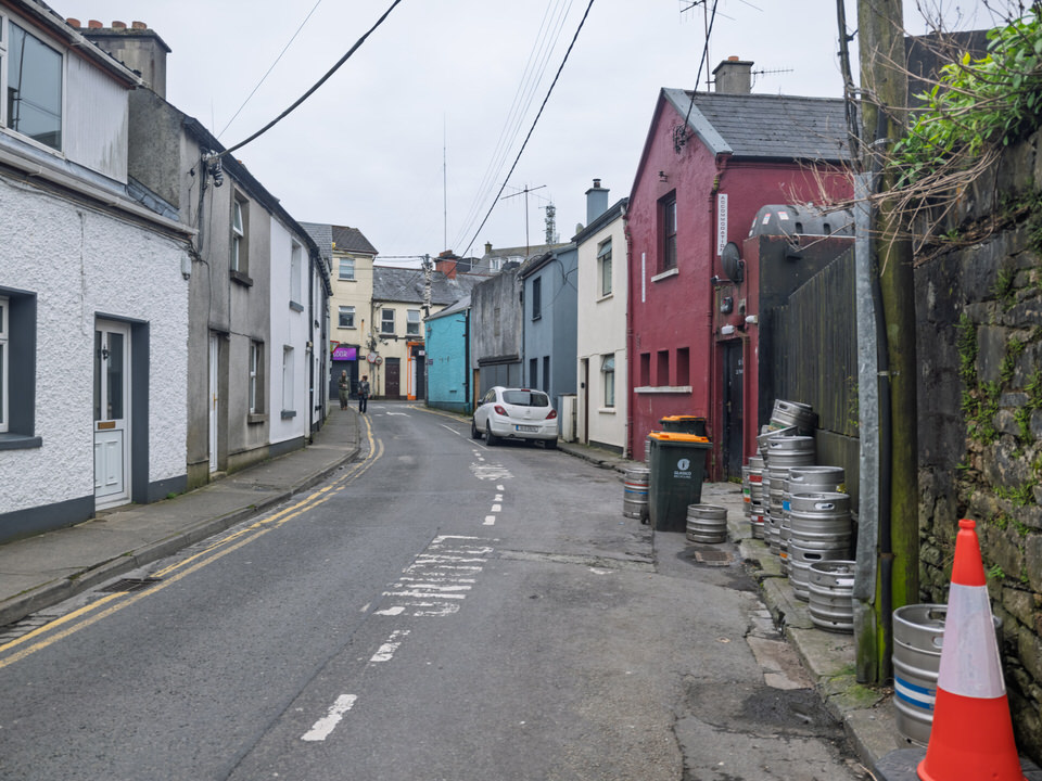
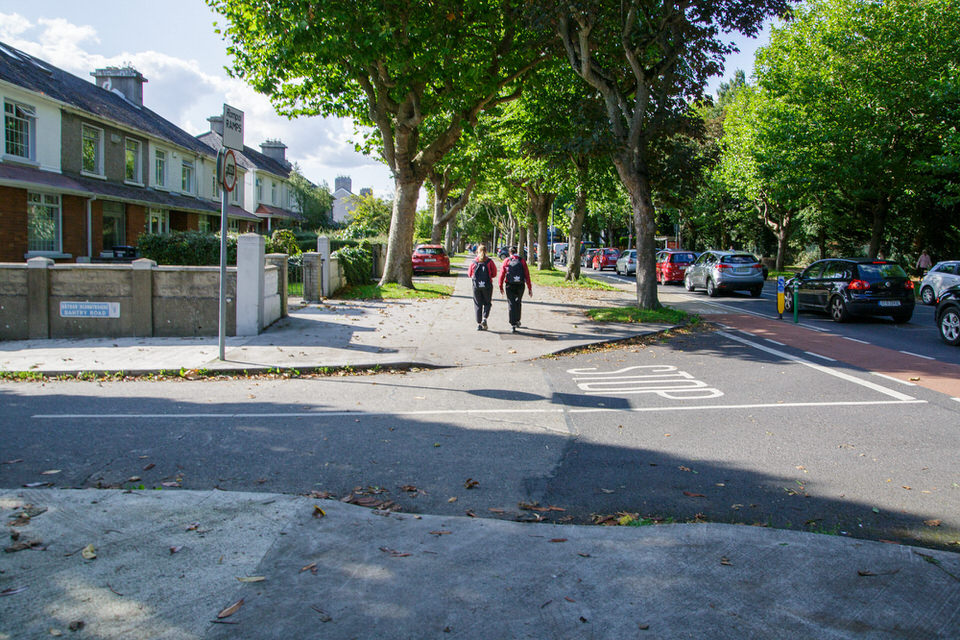
2009 Gas Explosion In Blackrock
Urban Cartographer on Saturday, 21st February
Emergency services described it as a 'miracle' that no one was killed when a mid-terrace house at St. Anne’s Square, Blackrock, was reduced to rubble on Friday, March 13th, 2009. The blast, occurring at 2:30 PM, leveled the property and severely damaged neighboring homes. Subsequent investigations by Bord Gáis confirmed a natural gas build-up as the cause, though the property was unoccupied at the time of ignition. The event led to the permanent demolition and eventual reconstruction of several units in the historic square.
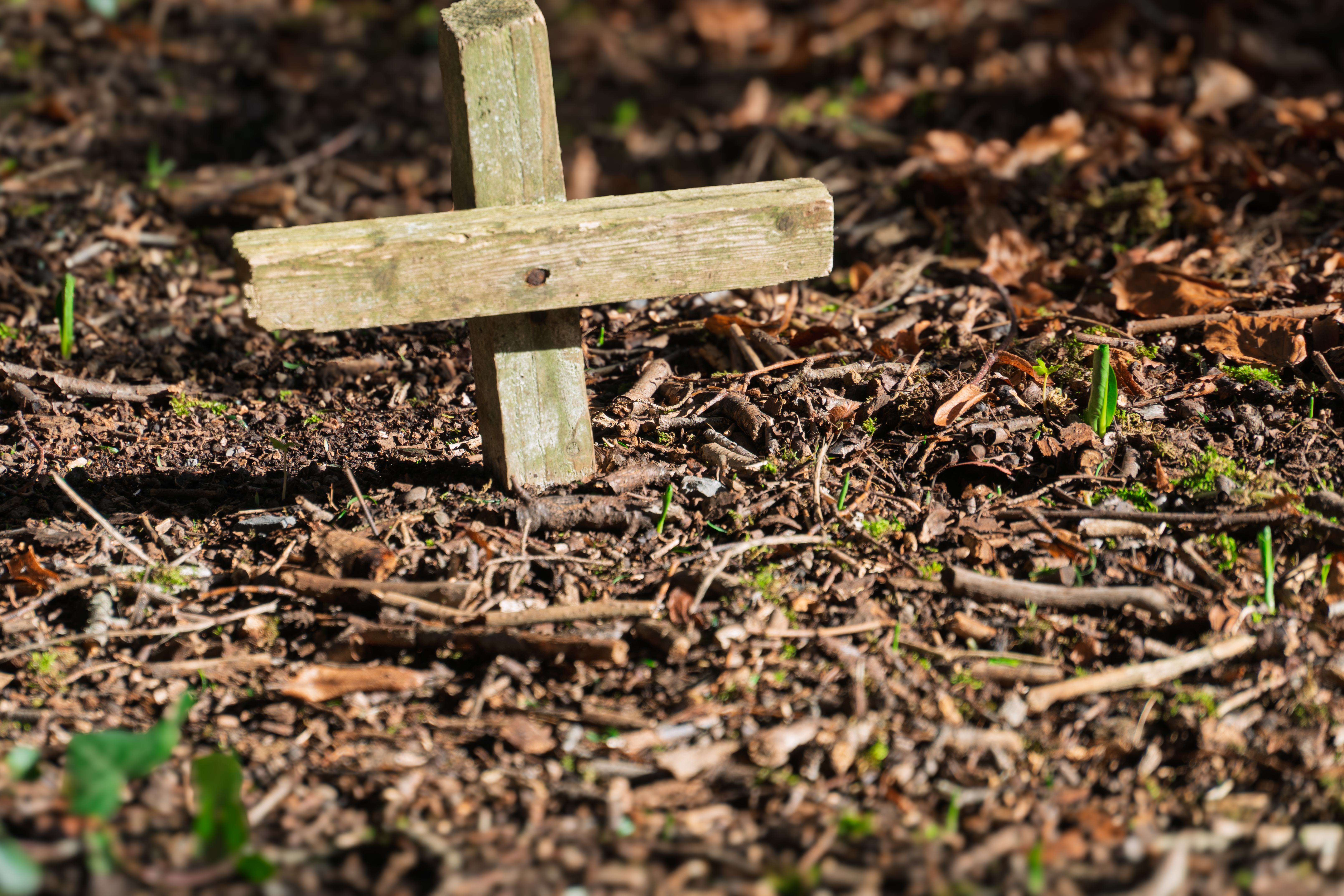
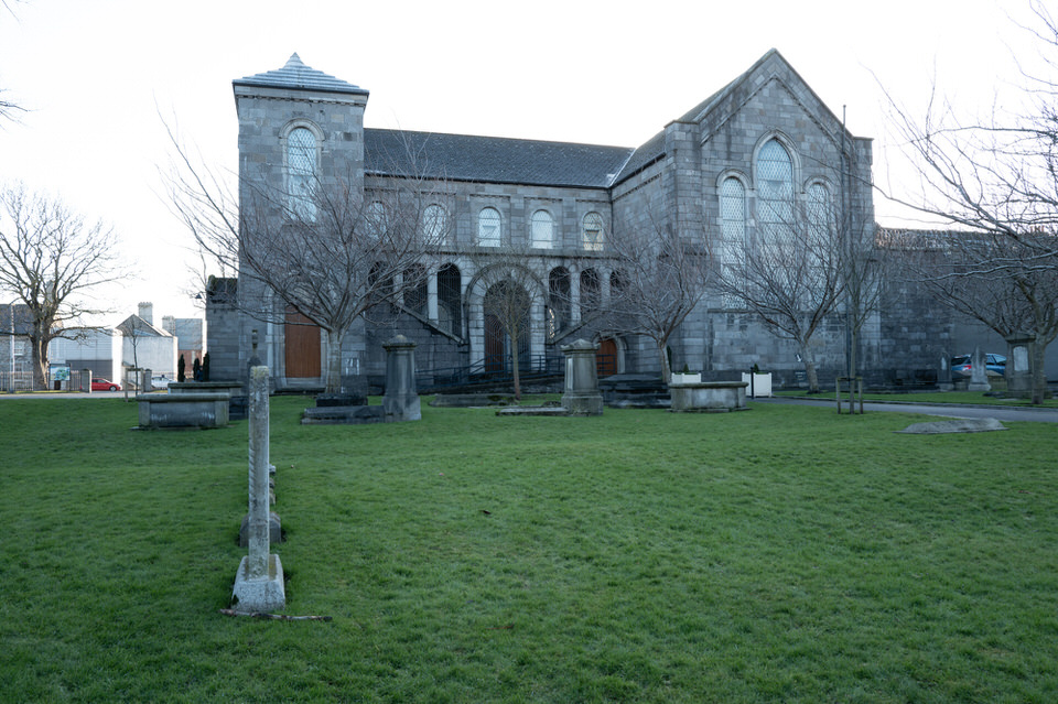
2016 Visit To The College Graveyard In Maynooth
The Urban Cartographer on Wednesday, 27th May
Discover the haunting history of Maynooth's hidden College Cemetery. From the tragic nineteenth-century reality behind the infamous Rhetoric House 'Ghost Room' to the final resting places of historical pioneers, explore the rich lore, architectural secrets, and fact-checked truths of Ireland's legendary seminary grounds.
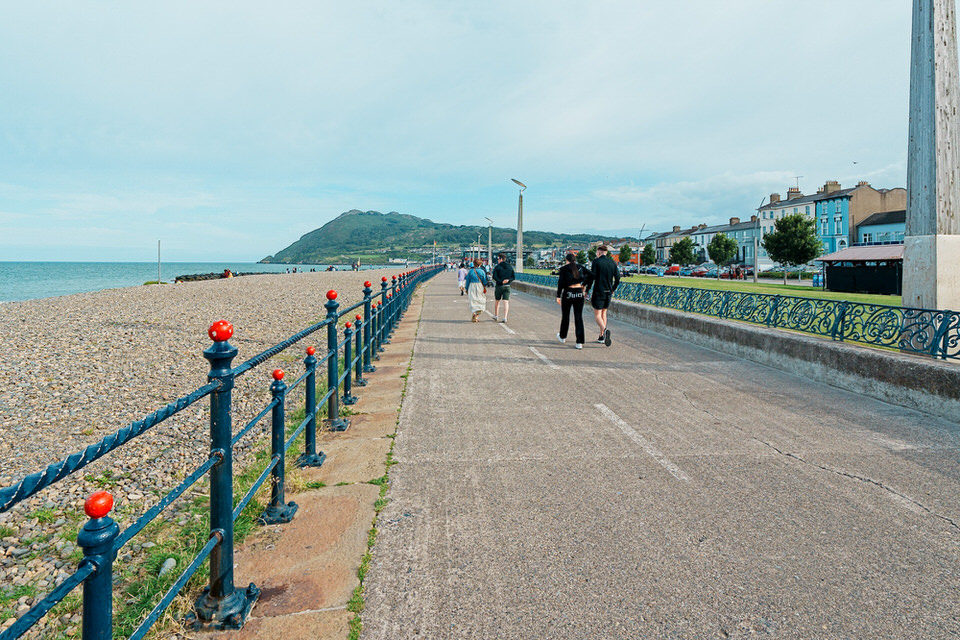
2025 New Year Day Visit To Sandycove
Urban Cartographer on Wednesday, 31st December
Sandycove Avenue forms three sides of a rectangle, bounded on the south by Sandycove Terrace (part of Sandycove Road). Originally, Sandycove Avenue East was a cul-de-sac leading to the Martello Tower (Joyce's Tower, Sandycove), as shown on maps from 1820. By 1860, only two houses stood on Sandycove Avenue East. Ten years later, significant building had occurred, including three houses designated Ellerslie Terrace, alongside detached and terraced houses. The 1901 census recorded 27 houses, five of which were vacant, with 98 occupants. Five houses were classified as first class. In 1884, the first meeting of the Dublin Bay Sailing Club took place at Number 7 Sandycove Avenue East, the home of Major Edward White. St Kilda's, a villa-style house on the east side, was owned by Francis Falkner, a grocer with shops in Grafton Street and London.
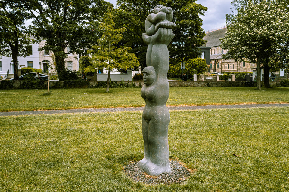
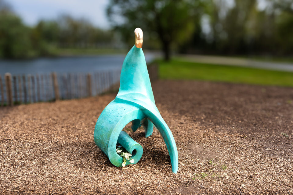
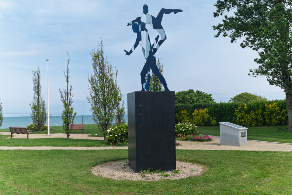
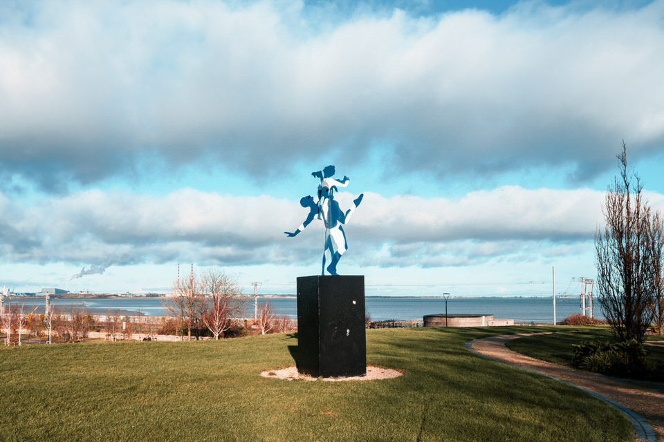
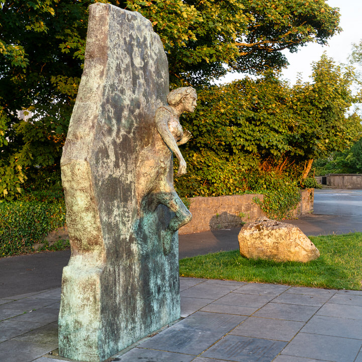
A Coastal Dialogue In Stone And Bronze
The Urban Cartographer on Wednesday, 20th May
Discover the fascinating multi-generational artistic dialogue on the Dublin coast between sculptors Dick and Rachel Joynt. This original article explores how 'Celebration' in Glasthule and 'Mothership' on the Dún Laoghaire promenade contrast ancient stone carving with interactive, environmental bronze casting.
A Day In The Life Of The Urban Cartographer 2 June 2026
The Urban Cartographer on Wednesday, 3rd June
A rainy June Bank Holiday in Dublin forces a shift in plans for *The Urban Cartographer*. Exploring the city's changing architecture and extreme weather patterns with the new high-resolution Sony A7RVI.
A Diary Update and Random Images of Dublin City Centre
The Urban Cartographer on Friday, 12th June
A chaotic Sunday transit delay across Dublin turns into a firmware test for the Leica Q3. Plus, a look at why Dublin street photography is shifting focus ahead of Ireland's upcoming 2026 EU Council Presidency and the massive European Political Community Summit.
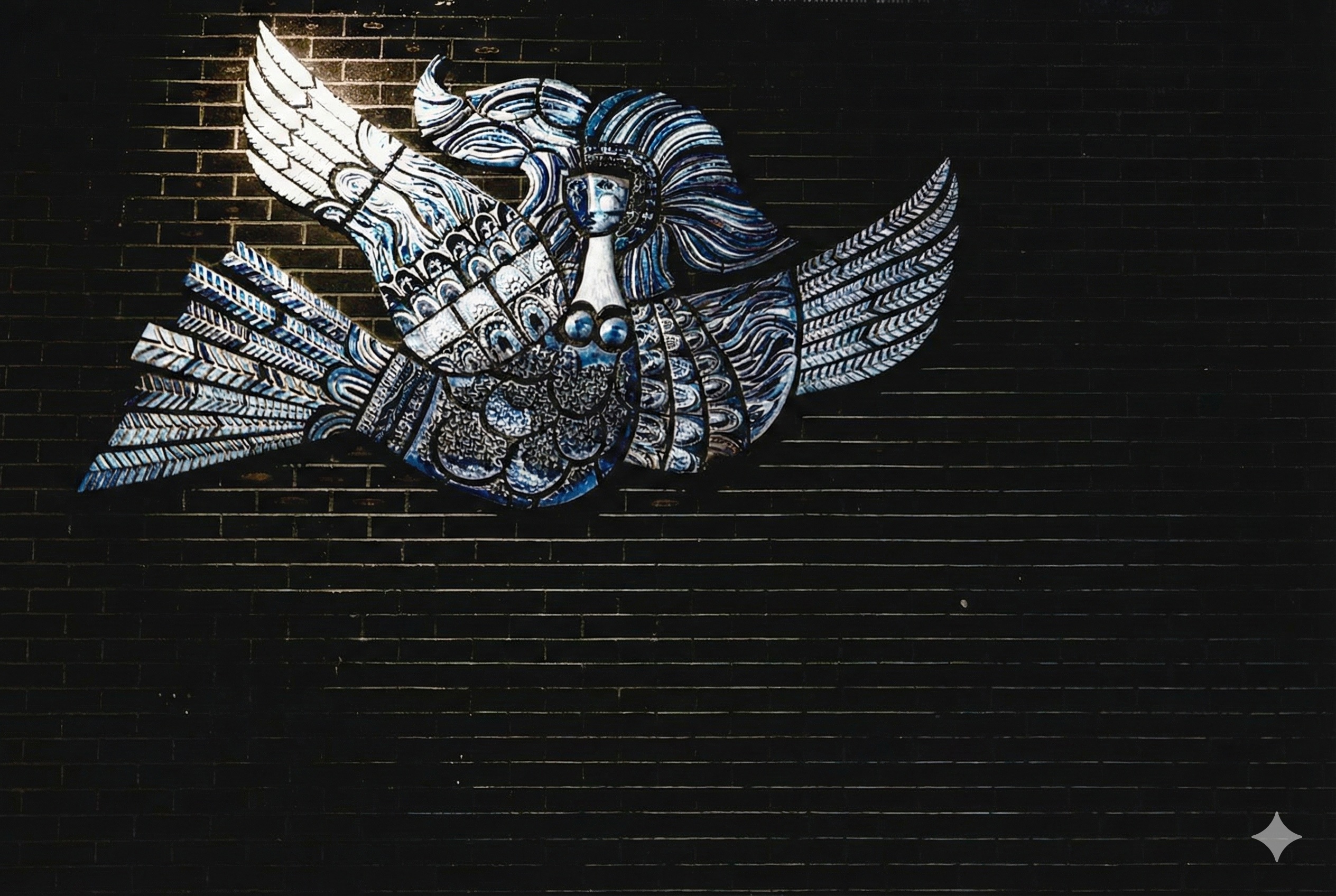
A Lost Fragment of Desmond Kinney’s Sweeney Astray
Urban Cartographer on Friday, 2nd January
Investigating the mystery of Desmond Kinney's "Sweeney Astray" mosaic. Although reported destroyed in 2013, photographic evidence from 2019 suggests a fragment of the famous "Bird Woman" survived hidden in the Irish Life Centre.
A Lovely Day Sculpture September 2016
The Urban Cartographer on Thursday, 5th March
Discover the work of Irish artist Marty Meinardi, whose sculpture "A Lovely Day" was a highlight of the 2016 Sculpture in Context exhibition at the National Botanic Gardens, Dublin. Explore the intersection of academic research and fine art in Meinardi’s multidisciplinary career.
A Quick Visit To Temple Bar 8 May 2026
The Urban Cartographer on Saturday, 9th May
Discover why Temple Bar in Dublin is a tale of two cities for families. While the daytime offers cobblestone charm, street performers, and the dedicated children’s cultural centre, The Ark, the night-time atmosphere shifts toward rowdy adult nightlife. Learn the best times to visit with kids to enjoy traditional music without the crowds.
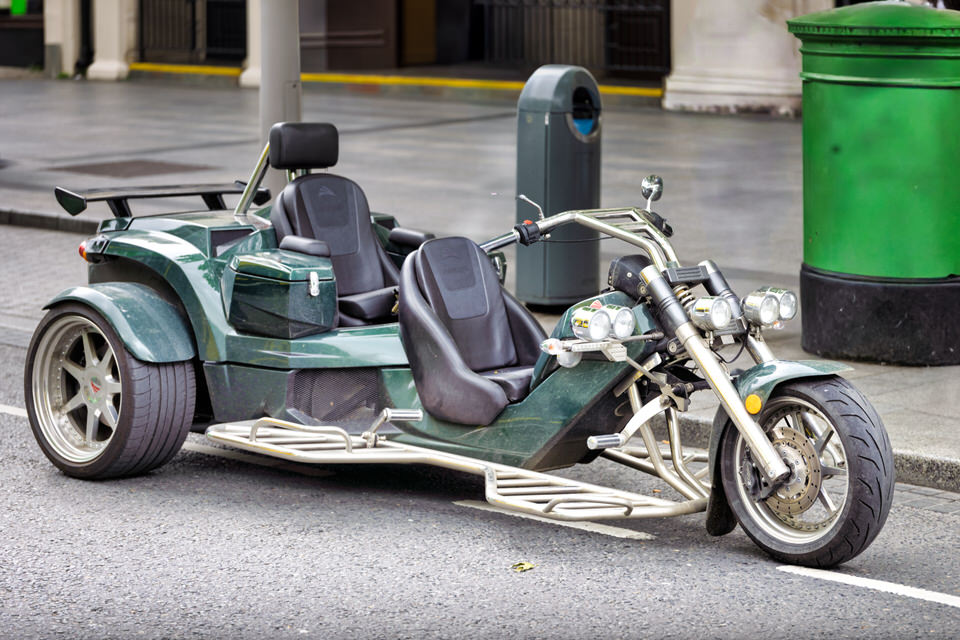
A Rewaco German Manufactured Trike As Seen On O'Connell Street
The Urban Cartographer on Tuesday, 2nd June
A striking dark green Rewaco commercial production trike parked on a Dublin street, showcasing its unique tandem bucket seating, high-end chrome forks, and custom wheels. This high-resolution street photography capture highlights modern urban transportation and exotic vehicle design in a bustling public space.
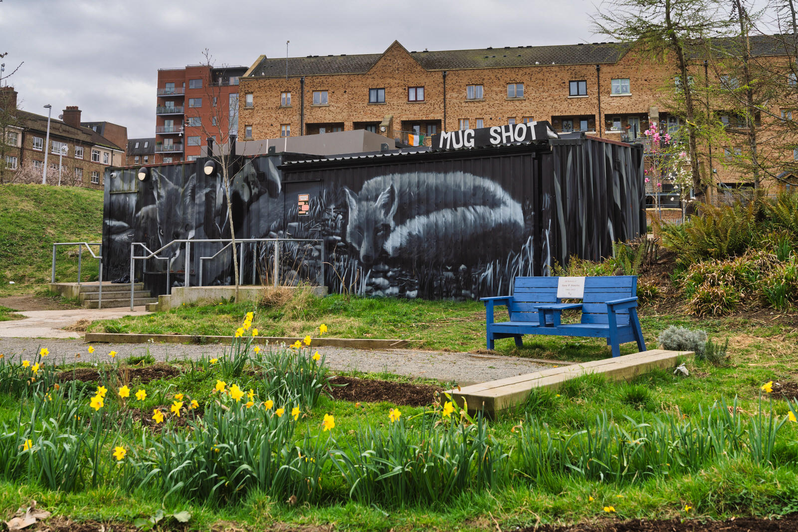
A Sanctuary in the City - The Garden of Remembrance and the Future of Parnell Square
Urban Cartographer on Friday, 9th January
Discover the history of Dublin's Garden of Remembrance and explore the ambitious new plans for the City Library Project at Parnell Square North. Learn how this historic Georgian square is being transformed into a modern cultural hub while honouring Ireland's past.
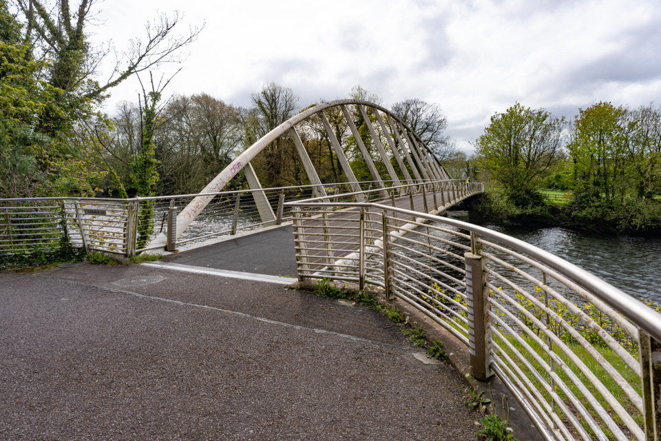
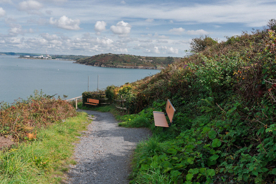
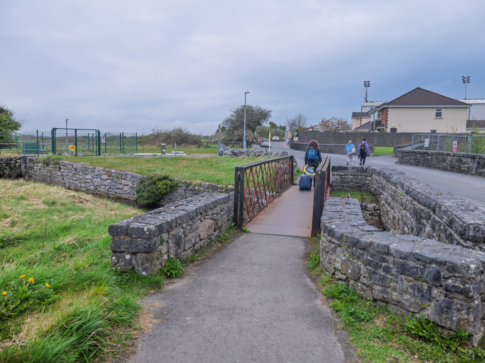
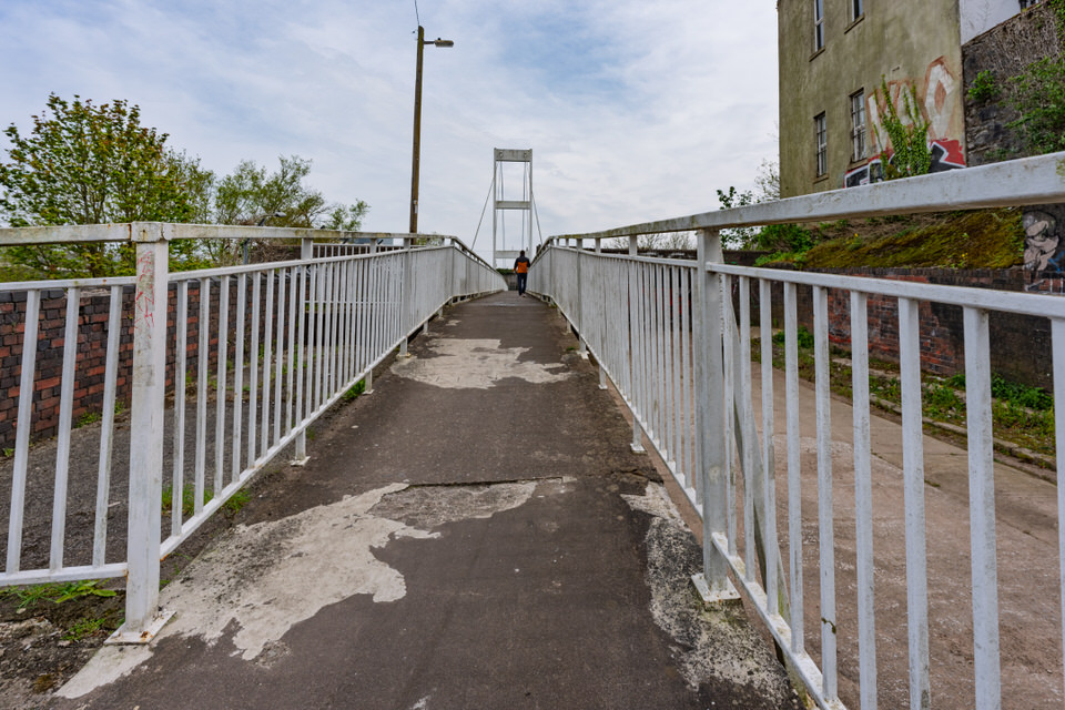
A Stroll Along Slí Chumann na mBan
The Urban Cartographer on Friday, 15th May
Take a historic riverside stroll from Wise’s Quay along Cork’s Slí Chumann na mBan Walkway. Discover the distilling heritage visible across the water, the 1916 republican history behind the path's name, and the modern footbridge linking directly to the Mardyke.
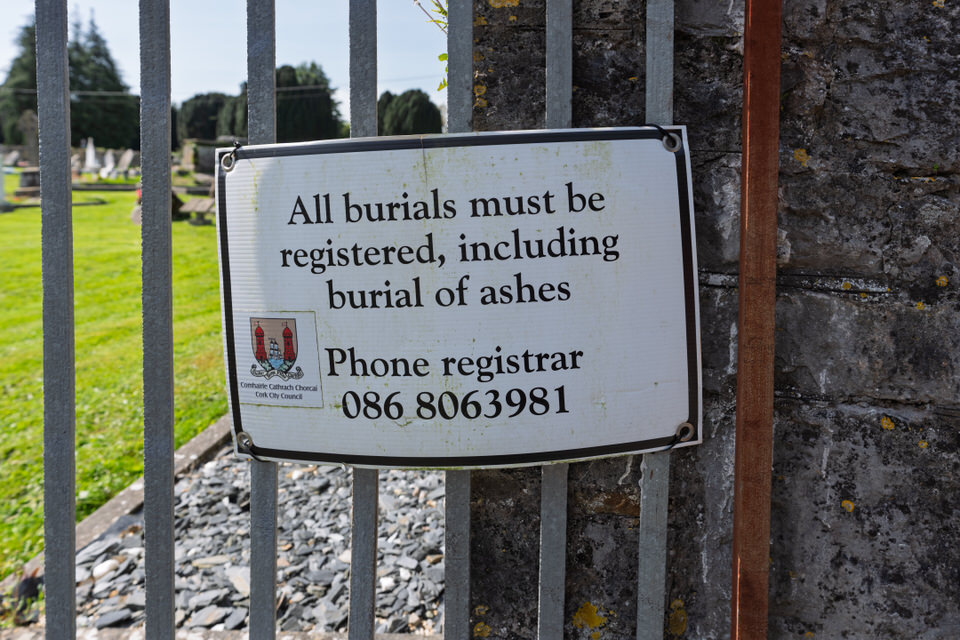
All Burials Must Be Registered
The Urban Cartographer on Wednesday, 29th April
Discover the history of Douglas Graveyard in County Cork. Learn why this former Church of Ireland site became a publicly managed cemetery, the significance of its modern burial notices, and the stories of body snatchers and war heroes interred within its walls.
All The Tractors And Trucks Are Gone
The Urban Cartographer on Sunday, 12th April
Discover how the Irish Government and An Garda Síochána successfully cleared the April 2026 fuel price blockades. This summary covers the "no-talks" policy under duress, the strategic deployment of the Defence Forces’ "Beast" recovery vehicles at Whitegate Refinery, and the specific excise duty cuts used to stabilise national fuel supplies and restore public order.
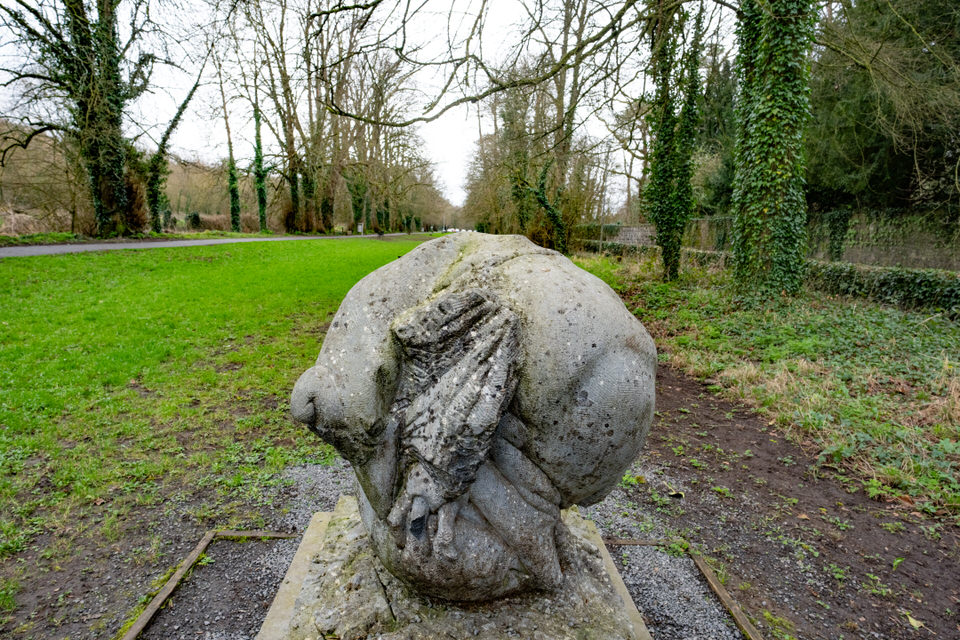
An Ugly Sculpture In Kilkenny
The Urban Cartographer on Saturday, 28th February
The Ram is a significant example of late 20th-century Irish stone sculpture, executed in the regional "black marble" for which Kilkenny is historically famous. Created by the renowned sculptor Dick Joynt—a leading figure in the Irish "direct carving" tradition—the work exemplifies his interest in heavy, curvilinear forms and the tactile relationship between the artist and the raw material.
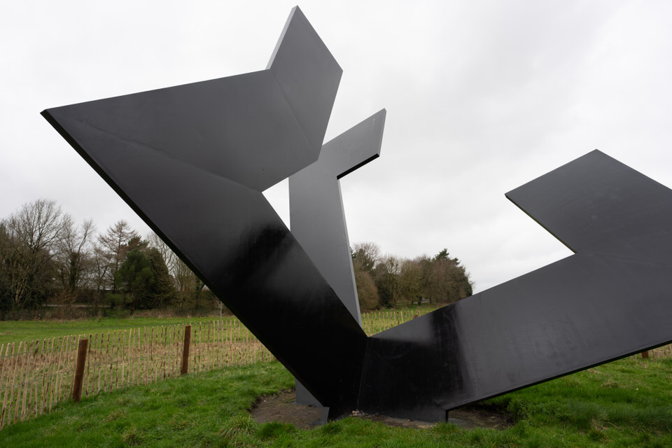
Anchored Void by Michael Warren
William Murphy on Friday, 27th February
Explore the evocative world of Michael Warren’s "Anchored Void" within the Kilkenny Castle Estate. Discover the history and inspiration behind one of Ireland’s leading site-specific sculptors, from the Viking-inspired forms of Dublin’s Wood Quay to the light-filled memorials of Wexford.

Apple WWDC 2026
The Urban Cartographer on Monday, 8th June
WWDC 2026 proved that building foundational models is vastly different from building premium hardware. By relying on competitors to power its primary consumer interface and hitting a regulatory brick wall in Europe, Apple's vision of an all-encompassing, private intelligent assistant feels more fragmented than ever. For a large portion of the world, the upgrade to iOS 27 will be defined not by what is added, but by what is missing.
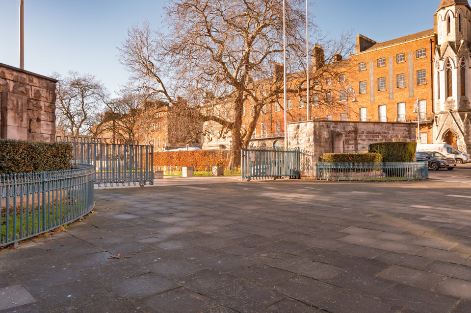
Arbour Hill And The 1916 Memorials
Urban Cartographer on Friday, 16th January
While the site acts as a general military cemetery, its primary significance lies in being the final resting place of 14 of the executed leaders of the 1916 Easter Rising. The memorial is notable for its sombre simplicity, contrasting sharply with the Victorian military architecture of the surrounding former prison complex.
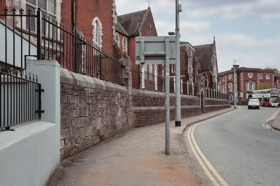
Atalia Road In Galway April 2026
The Urban Cartographer on Monday, 6th April
Explore the unique history and social fabric of Lough Atalia Road in Galway. From the private shoreline gardens and affluent residential mix to the industrial heritage of the Galway Docks and the historic Forthill Graveyard, discover the story of one of the West of Ireland’s most scenic and historic coastal routes.
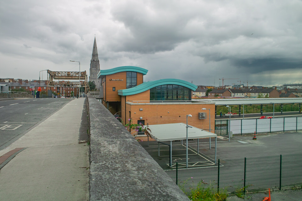
Back In August 2009 The Docklands Area Was Depressing
The Urban Cartographer on Monday, 8th June
A retrospective look at the transformation of the Dublin Docklands in August 2009. Correcting a camera metadata error reveals a fleeting snapshot of Santiago Calatrava’s Samuel Beckett Bridge just weeks after its historic rotation, alongside the final push for the Luas Red Line extension to The Point.
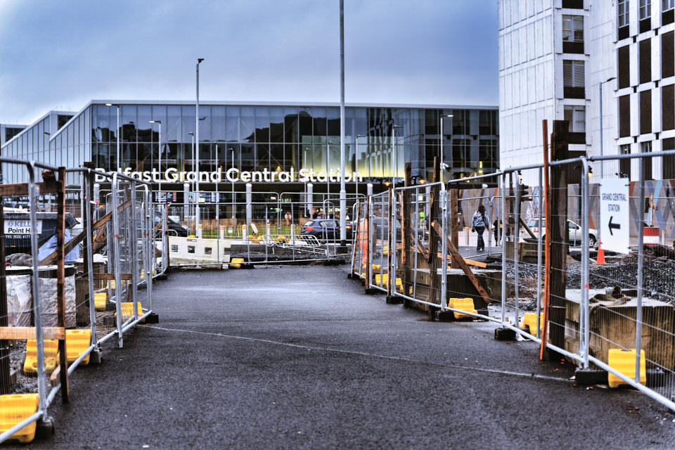
Belfast Grand Central
Urban Cartographer on Friday, 6th February
The All-Island Strategic Rail Review outlines a transformative future for rail in Ireland, with Belfast Grand Central Station at its core. From reopening the Antrim-Lisburn line to restoring rail to Omagh and Armagh, these plans aim to double passenger capacity and connect 700,000 more people to the network by 2050.
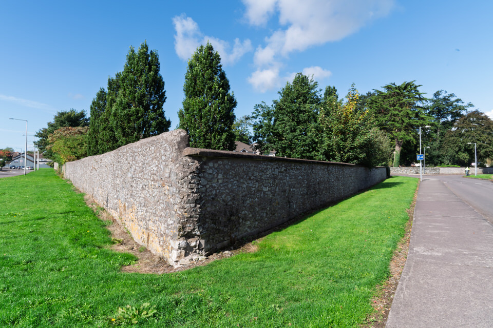
Bishopmeadows Walk August 2018
The Urban Cartographer on Saturday, 2nd May
A retrospective on Kilkenny's Bishopmeadows trail, comparing the wilder access of 2018 to the structured pathways of 2026. Discussing a shift to minimalist photography with the Leica Q3 and Fujifilm GFX100RF, and how improved bus frequencies have transformed the hiking experience along the River Nore.
Blackhorse Avenue In January 2026
Urban Cartographer on Tuesday, 13th January
Discover the history of Blackhorse Avenue, Dublin 7. From the medieval 'Blackhorse Inn' to the architectural splendour of McKee Barracks and the 1875 stone bridge over the railway cutting, explore this unique road on the edge of Phoenix Park. Read about its military connections, local landmarks, and current redevelopment trends.
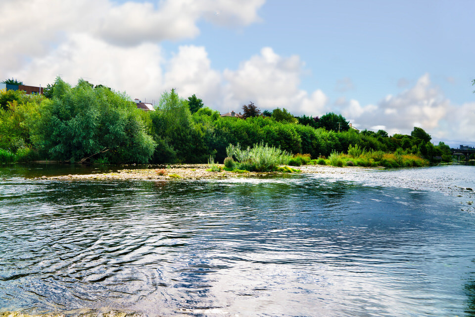
Blackrock Castle In Cork September 2018
The Urban Cartographer on Sunday, 29th March
A personal review of visiting Blackrock Castle and Observatory in Cork, Ireland. Discover the reality of the 6 km riverside walk, tips on navigating the 202 bus route, and why September might be the best time to avoid the Irish rain.
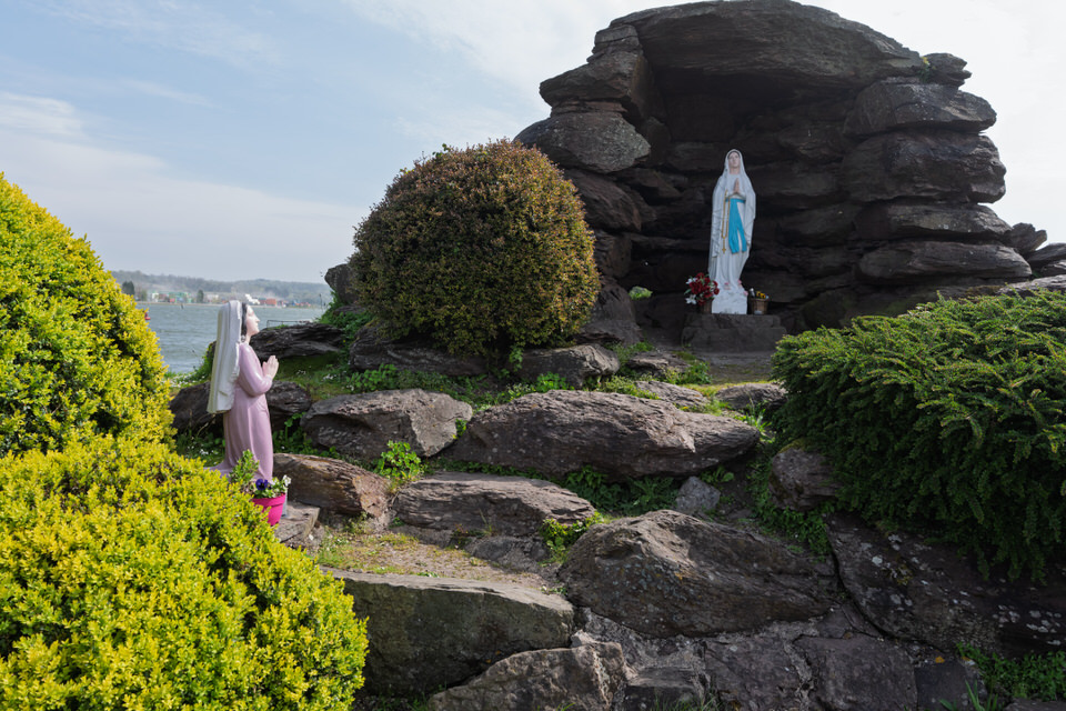
Blackrock Grotto In Cork
The Urban Cartographer on Sunday, 26th April
Explore the history of the Our Lady of Lourdes Grotto in Blackrock, Cork. Built in 1958 to mark the Lourdes Centenary, this Marian shrine at Blackrock Pier remains a symbol of protection for local fishermen and a testament to the village's strong community spirit.
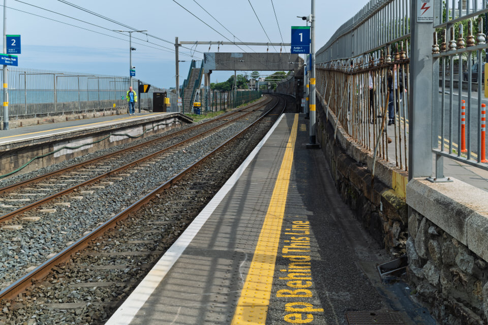
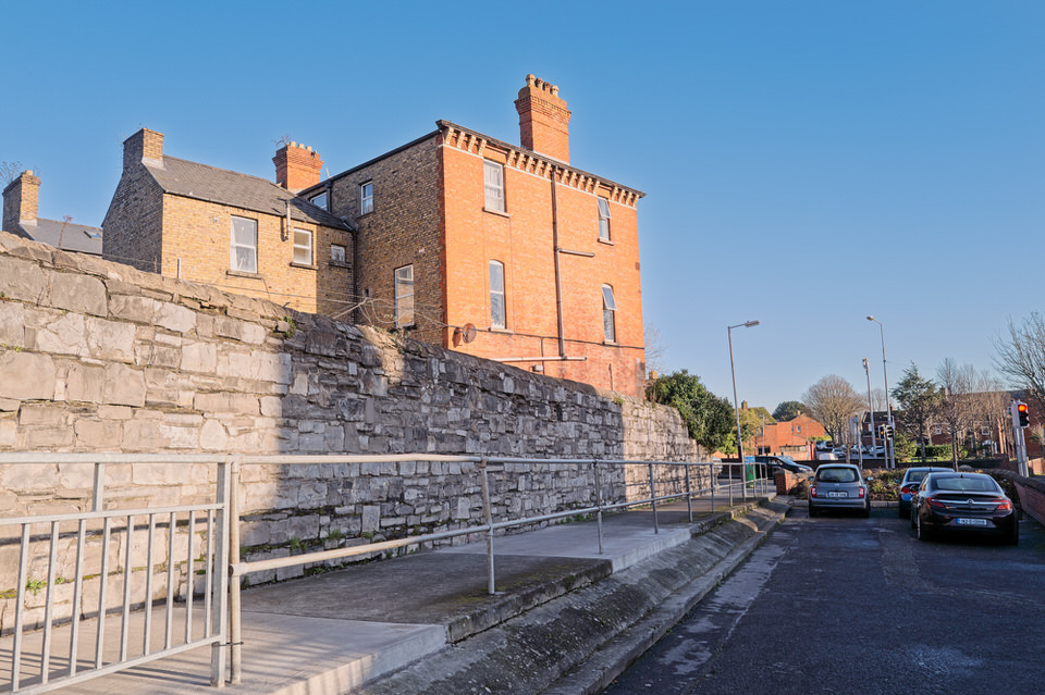
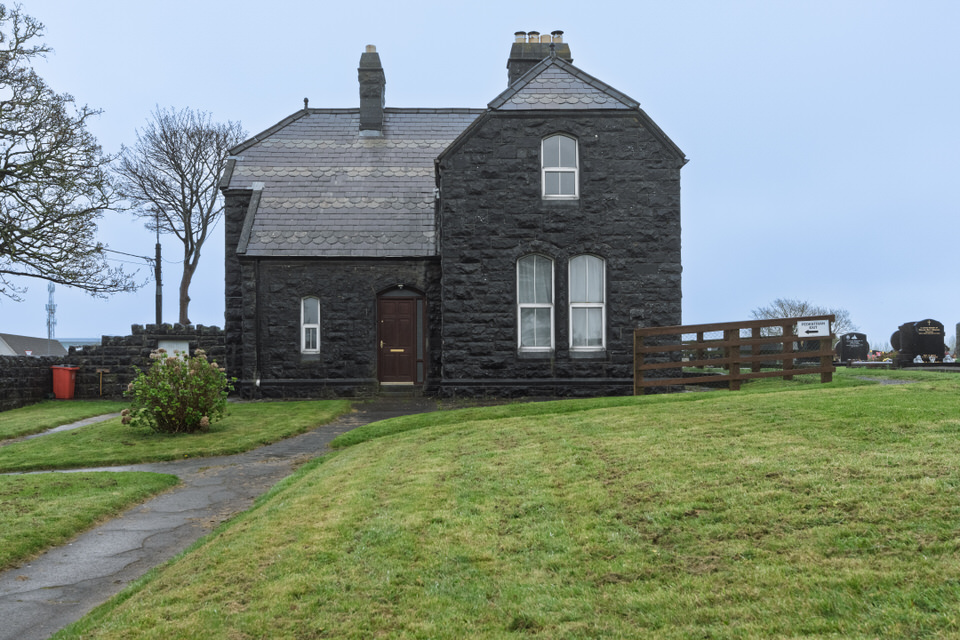
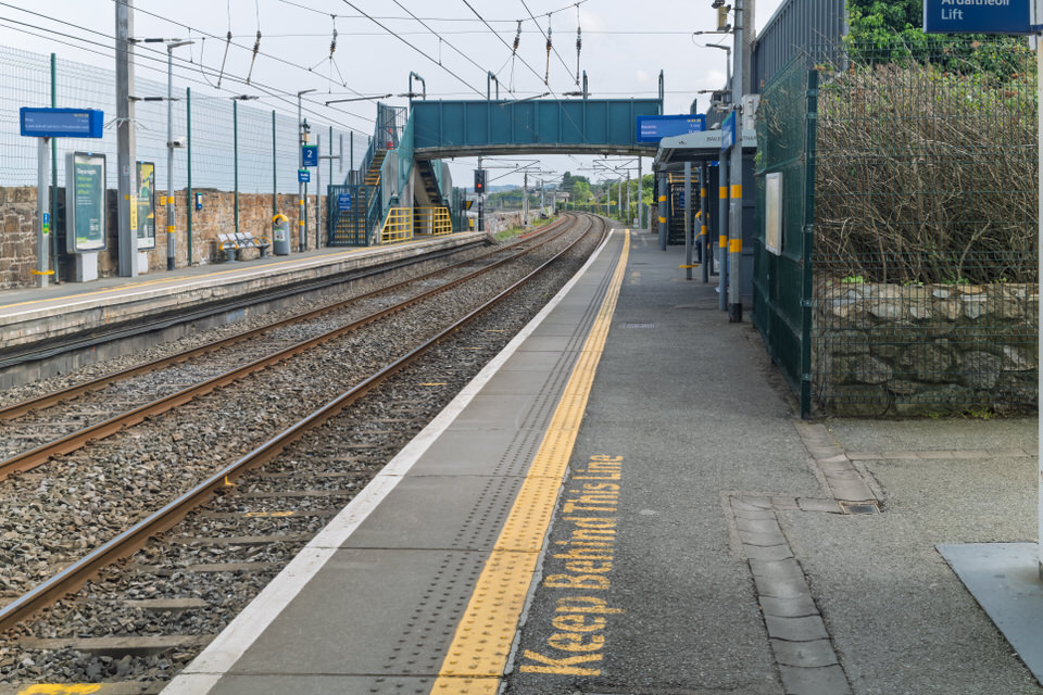
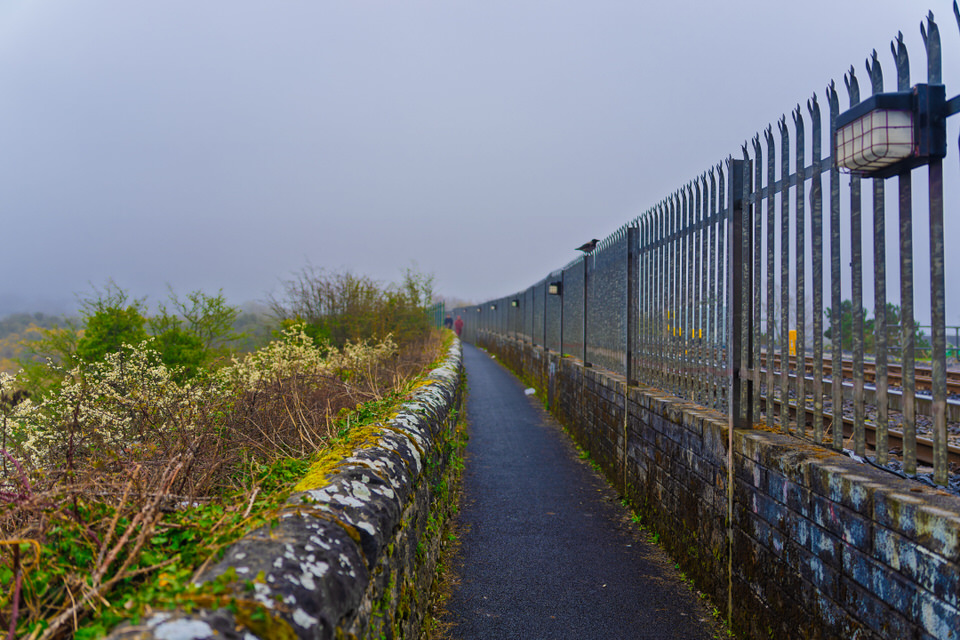
Blackrock Station Past And Future
The Urban Cartographer on Saturday, 9th May
Discover the heritage and current status of Blackrock Train Station. This post explores its 1834 origins, the Victorian architectural preservation, and provides a corrected update on the DART+ fleet modernisation. Learn about the delays facing the new battery-electric trains following international trial concerns and the future infrastructure plans for the South Dublin coastal line.
Bob And Joans Walk In Cork City April 2026
The Urban Cartographer on Tuesday, 19th May
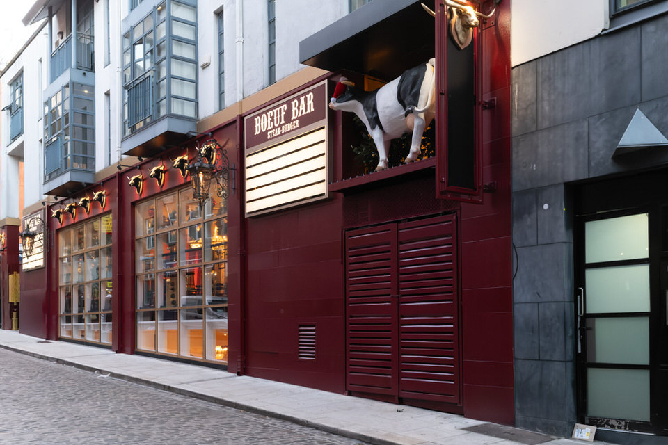
Boeuf Steak-Burger Bar
William on Monday, 24th November
Bohermore Cemetery August 2016
The Urban Cartographer on Monday, 23rd March
A photographic study of Galway’s Bohermore Cemetery. Captured with an ultra-wide Voigtlander lens, these images reveal the stories behind this Victorian-era site.
Bohermore Where Lord Haw Haw Is Buried
The Urban Cartographer on Saturday, 4th April
Explore the history and architectural nuances of Bohermore Cemetery in Galway. Originally opened in 1880, this "New Cemetery" challenges the traditional definition of Victorian funerary style while serving as the final resting place for figures like Lady Gregory and William Joyce.
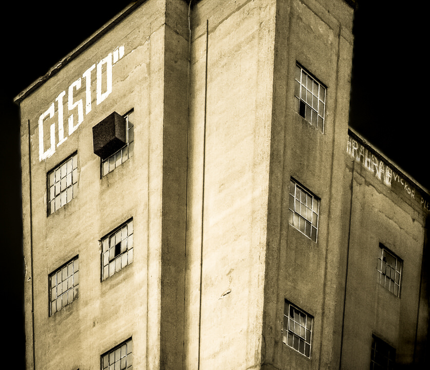
Bolands Mills Complex As It Was In March 2009
The Urban Cartographer on Thursday, 11th June
Discover the architectural transformation of Dublin’s historic Bolands Mills at Grand Canal Dock. This article explores the dramatic redevelopment that balanced the preservation of 19th-century stone warehouses with the total demolition of its iconic mid-century concrete silos to create a modern tech and residential hub.
Bolton Street College Car Park
Urban Cartographer on Saturday, 14th February
An exploration of the "permanently full" car park sign at Bolton Street College, Dublin. Discussing the transition to digital permits, the use of signage as a deterrent, and why empty parking spaces often appear as "Full" in city centre institutions.
Booterstown Nature Reserve And Station
The Urban Cartographer on Saturday, 9th May
Discover Booterstown Nature Reserve, a unique saltmarsh sanctuary in South Dublin. Located adjacent to Booterstown DART station, this UNESCO Dublin Bay Biosphere site is a haven for migratory birds and rare flora. Learn about birdwatching opportunities, transport links, and the ecological significance of this urban wilderness.
Bray County Wicklow July 2023
The Urban Cartographer on Tuesday, 5th May
Discover the transformation of Bray, County Wicklow, from its Victorian heyday as the "Brighton of Ireland" to its 2026 rebirth as a hub of coastal urbanity. Explore its cultural legacy, the impact of the Northern Irish "July Fortnight," and the town's modern evolution, including the opening of the Marine Life Aquarium.
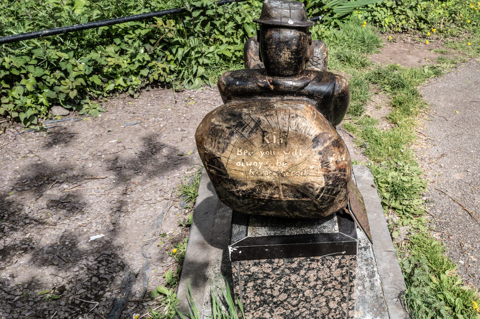
Brian Quilligan Memorial At Lee Fields
The Urban Cartographer on Saturday, 25th April
The Brian Quilligan memorial at the Lee Fields in Cork is a poignant tribute to a 19-year-old local man who tragically drowned while fishing in October 2011. Created by renowned sculptor Mick Wilkins, the lifelike monument depicts an angler overlooking the River Lee near the Salmon Weir, serving as both a personal family memorial and a landmark of water safety in Cork City.
Bridgefoot Street And Park April 2025
The Urban Cartographer on Thursday, 7th May
Bridgefoot Street Park, a recent addition to the Liberties area of Dublin 8, stands as a testament to urban regeneration and community engagement.

Buying From Amazon Is No Longer Worth The Effort
The Local Know-All on Friday, 29th May
The post-Brexit shift completely broke what used to be a seamless procurement route for photographers in Ireland. The transition from the frictionless UK, US, and German Amazon marketplaces to the localized Irish operation has been incredibly frustrating, and my experience highlights a massive systemic decline in both retail value and basic logistical security.
CAPTAIN PLAYS DEAD
William on Friday, 21st November
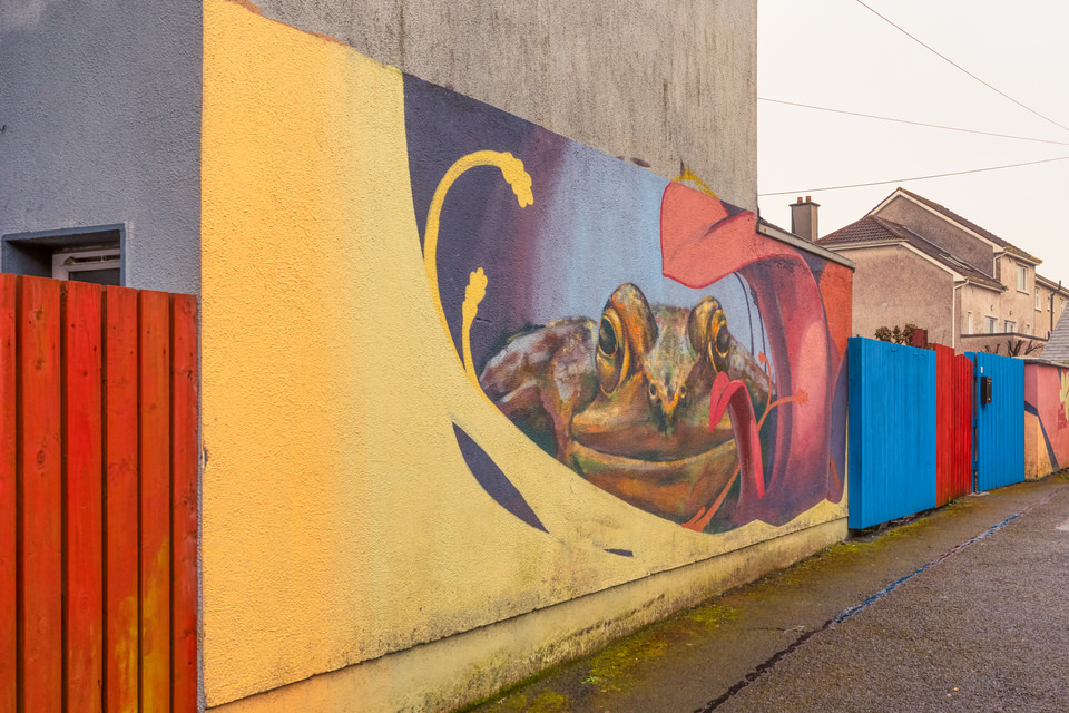
Cabbage Lane Murals
The Urban Cartographer on Saturday, 4th April
Discover the hidden gems of Bohermore with a stroll through Cabbage Lane, Galway. Recently transformed by the "Greening the Laneways" project, this historic passage features vibrant community-led murals and floral street art. Learn about the rich history of the "Great Road" and how local residents are using urban art to revitalise one of Galway's oldest residential districts.
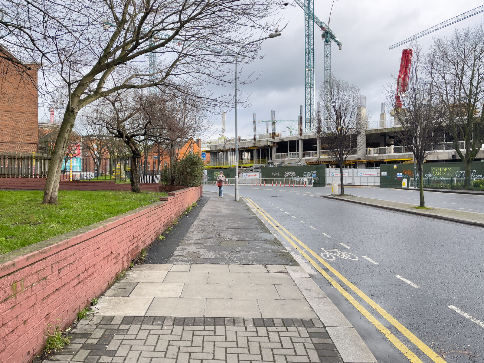
Camden Yard Failed Development Kevin Street
The Urban Cartographer on Tuesday, 14th April
Discover the fascinating history of Kevin Street College, from its 1960s heyday with cutting-edge NC machines to the failed Camden Yard development. This post explores the site's transition from a premier technical school to Dublin City Council’s newest civic headquarters.

Camper Van Culture Varies From Country To Country
The Urban Cartographer on Wednesday, 3rd June
Explore the major differences between UK/Irish camper van culture and American RV travel. From vehicle size and narrow roads to the recent SNP motorhome scandal, discover how geography and lifestyle shape life on the road.
Capel Street On St Patricks Day 2026
The Urban Cartographer on Sunday, 10th May
Explore the transformation of Capel Street, Dublin’s longest traffic-free thoroughfare. This guide examines the surge in hotel construction, including major developments like Motel One and new boutique aparthotels, detailing how pedestrianisation is reshaping the hospitality landscape in the heart of Dublin 1.
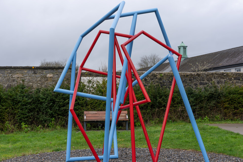
Celebration By Dick Joynt
Urban Cartographer on Monday, 19th January
Dick Joynt, was a master of stone and bronze whose work possessed a "primitive" and enduring strength. He was a central figure in 20th-century Irish sculpture
Charlemont Place On The Grand Canal
Urban Cartographer on Sunday, 15th February
Discover the transformation of Charlemont Place along Dublin’s Grand Canal. From its 18th-century industrial roots to the modern Charlemont Square development, explore the history, current commercial status, and the legality of the iconic residential barge homes on the north bank.
Cheers The Paint-A-Box Art By Zippy
Urban Cartographer on Saturday, 7th February
Explore the vibrant street art of the Belfast Canvas Project. Despite battling severe winter weather with a Leica Q3, we document "Cheers!" by Zippy and the city's unique utility box transformations.
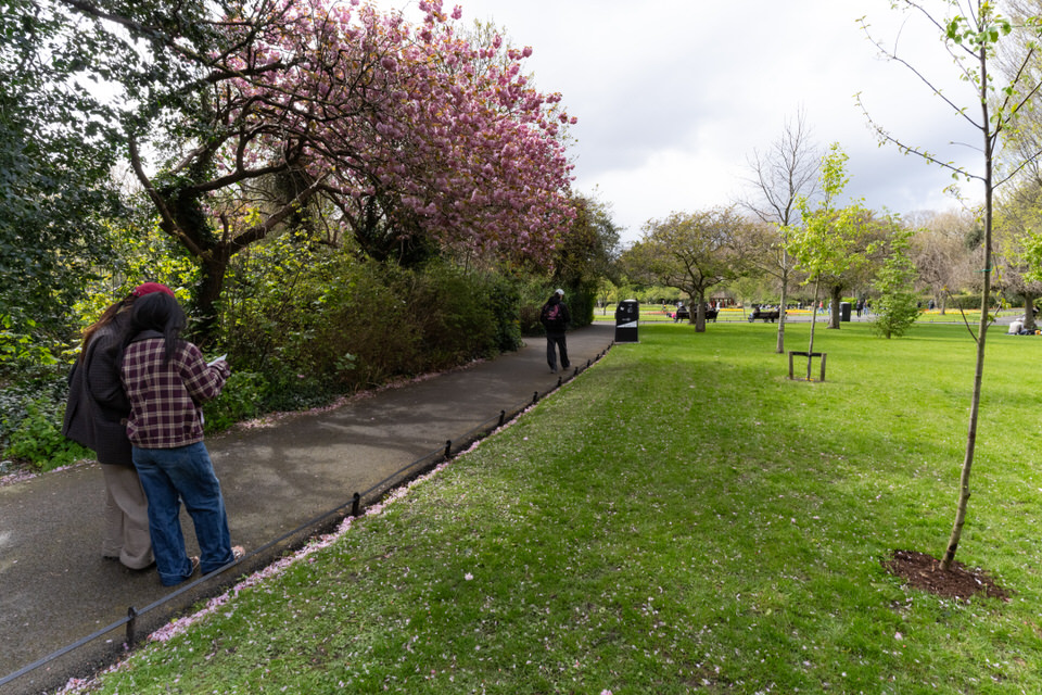
Cherry Blossoms In St Stephens Green
The Urban Cartographer on Sunday, 12th April
Explore the history and changing seasons of cherry blossoms in Ireland. Discover how the "May blossoms" of the 1950s have shifted to early April due to rising temperatures, and learn about the ancient native Wild Cherry protected under Brehon Law.
Chornobyl Mother By Sandra Bell
The Urban Cartographer on Wednesday, 29th April
Explore the newly unveiled Chornobyl Mother sculpture by Sandra Bell in Marina Park, Cork. Commissioned to mark the 40th anniversary of the nuclear disaster, this memorial honours the long-standing humanitarian bond between Cork and the children of Ukraine and Belarus through Adi Roche’s CCI.
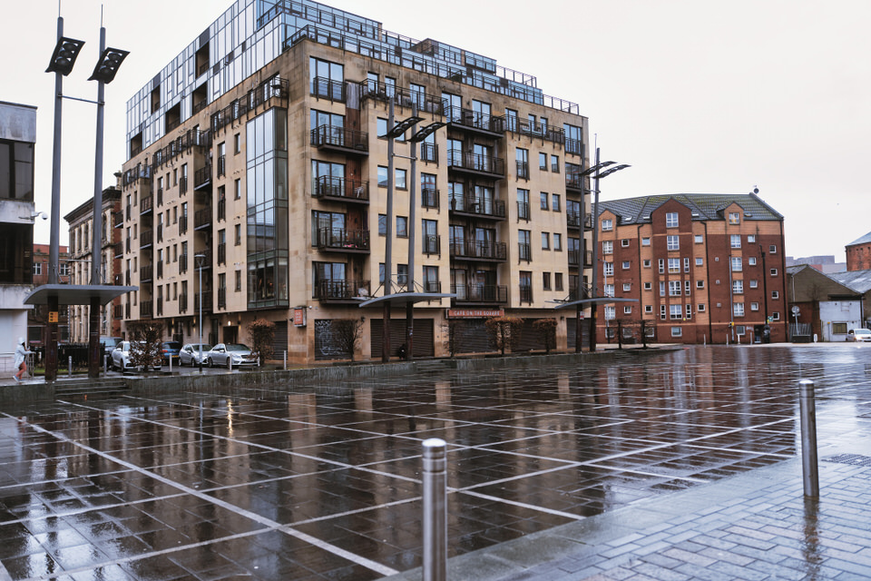
City Quay December 2025
Urban Cartographer on Wednesday, 11th February
Discover how Belfast’s new urban landscape is changing everything from wildlife behaviour to iconic tourist views. Explore the "anvil" foraging techniques of gulls at City Quays and the controversial "Great Wall of Queen’s Island" that is hiding the Titanic Belfast museum from the city skyline.
Commemorating The 1916 Easter Rising - Cut Out People By Dan Mac Carthy
The Urban Cartographer on Friday, 8th May
Discover the "Cut Out People" sculpture by Danny MacCarthy in Blackrock Park. This moving installation in the 1916 Memorial Garden commemorates the Easter Rising centenary through a powerful use of silhouette and negative space. Explore the intersection of Irish history and contemporary art in this peaceful Dublin sanctuary.
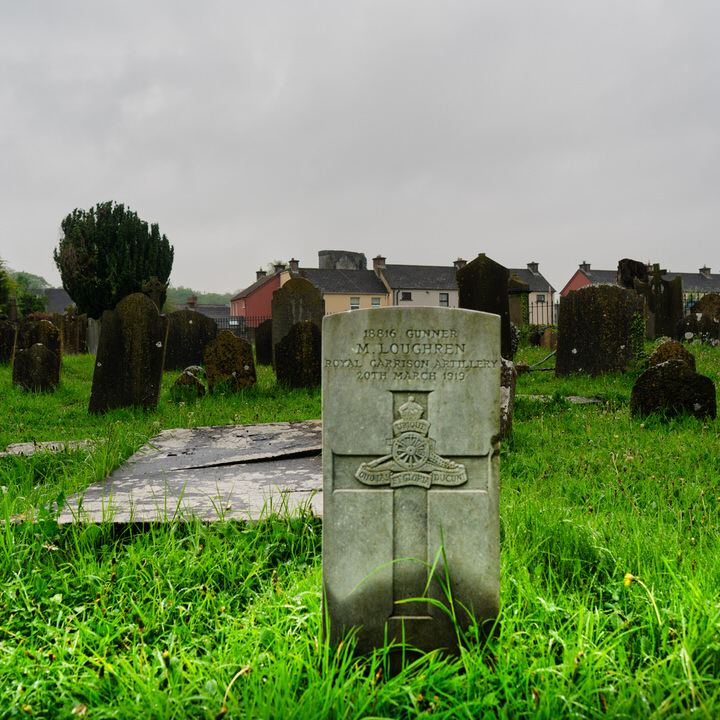
Commonwealth War Grave for Gunner M. Loughren 18816
The Urban Cartographer on Tuesday, 3rd March
Remembering Gunner M. Loughren (18816) - A Great War Legacy in Kilkenny. Discover the history of Gunner M. Loughren of the Royal Garrison Artillery, buried at St John's Churchyard, Kilkenny. Explore the significance of this Commonwealth War Grave and the role of Irish soldiers in the First World War.
Construction Project At Constitution Hill Flats
on Wednesday, 14th January
Construction is underway on the regeneration of Dublin's Constitution Hill flats. Led by Grafton Architects, the project retrofits 1960s social housing to deliver 124 energy-efficient homes near Broadstone Luas. Phase 1 is due for completion in Summer 2027.
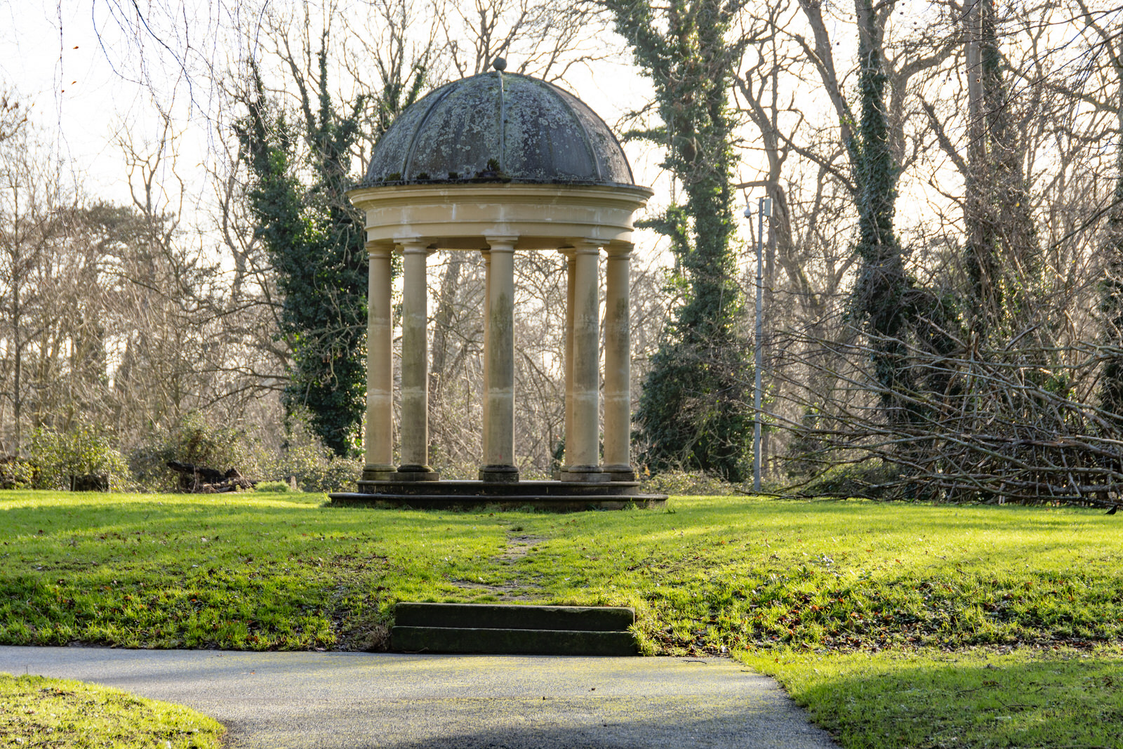
Copy Of A Stone Temple
Urban Cartographer on Wednesday, 31st December
Santry Demesne Public Park holds within its boundaries echoes of a grand past, most notably through a replica of a once-prominent stone temple. This temple, however, is not the original.
Cork Harbour As Seen From Fort Meagher
The Urban Cartographer on Saturday, 18th April
Explore the strategic majesty of Fort Camden Meagher in Crosshaven. This guide details the historic views of Cork Harbour, the fort's dual British and Irish nomenclature, and the immense geographical importance of the world's second-largest natural harbour.
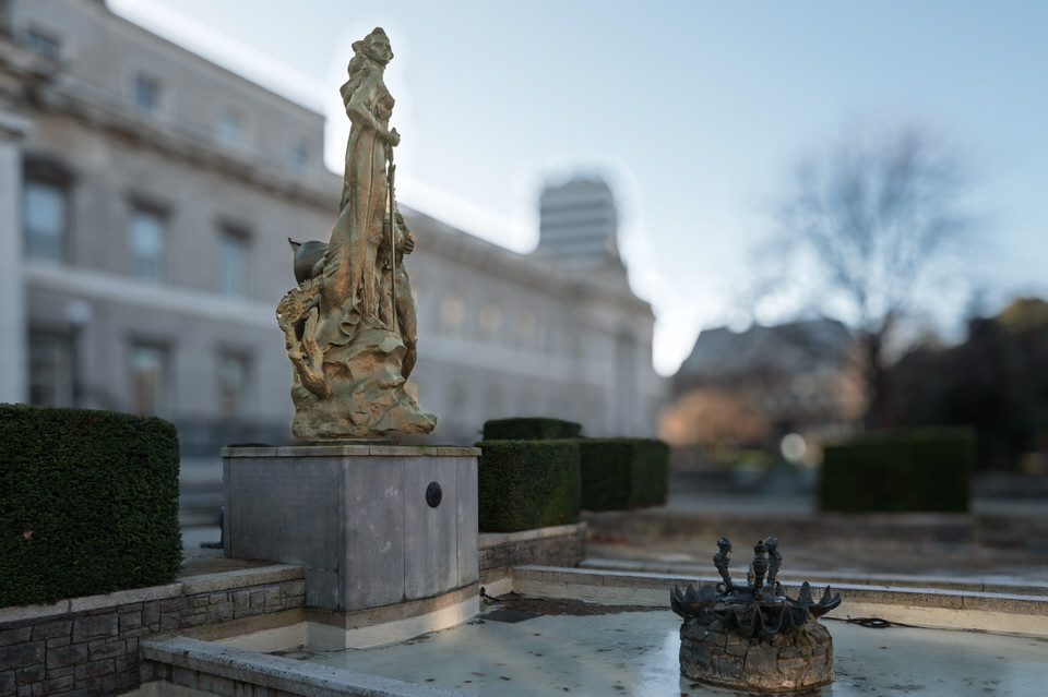
Custom House Attack Memorial
Urban Cartographer on Tuesday, 6th January
Discover the history behind the Custom House Memorial in Dublin. We explore the rugged bronze sculpture by Breton artist Yann Renard-Goulet, depicting the mythical figure of Éire and the tragic 1921 burning of the Custom House.
Custom House Square And Nearby
Urban Cartographer on Tuesday, 10th February
Discover the history and modern vibrancy of Custom House Square, Belfast’s premier outdoor event space. From its 19th-century Lanyon-designed architecture and the historic "Speaker’s Corner" to its current status as a concert hub served by the Belfast Glider, explore why this square is the beating heart of the city’s waterfront.
Cut Out People January 2025
The Urban Cartographer on Friday, 8th May
Discover the "Cut Out People" sculpture by Danny MacCarthy in Blackrock Park. This moving installation in the 1916 Memorial Garden commemorates the Easter Rising centenary through a powerful use of silhouette and negative space. Explore the intersection of Irish history and contemporary art in this peaceful Dublin sanctuary.
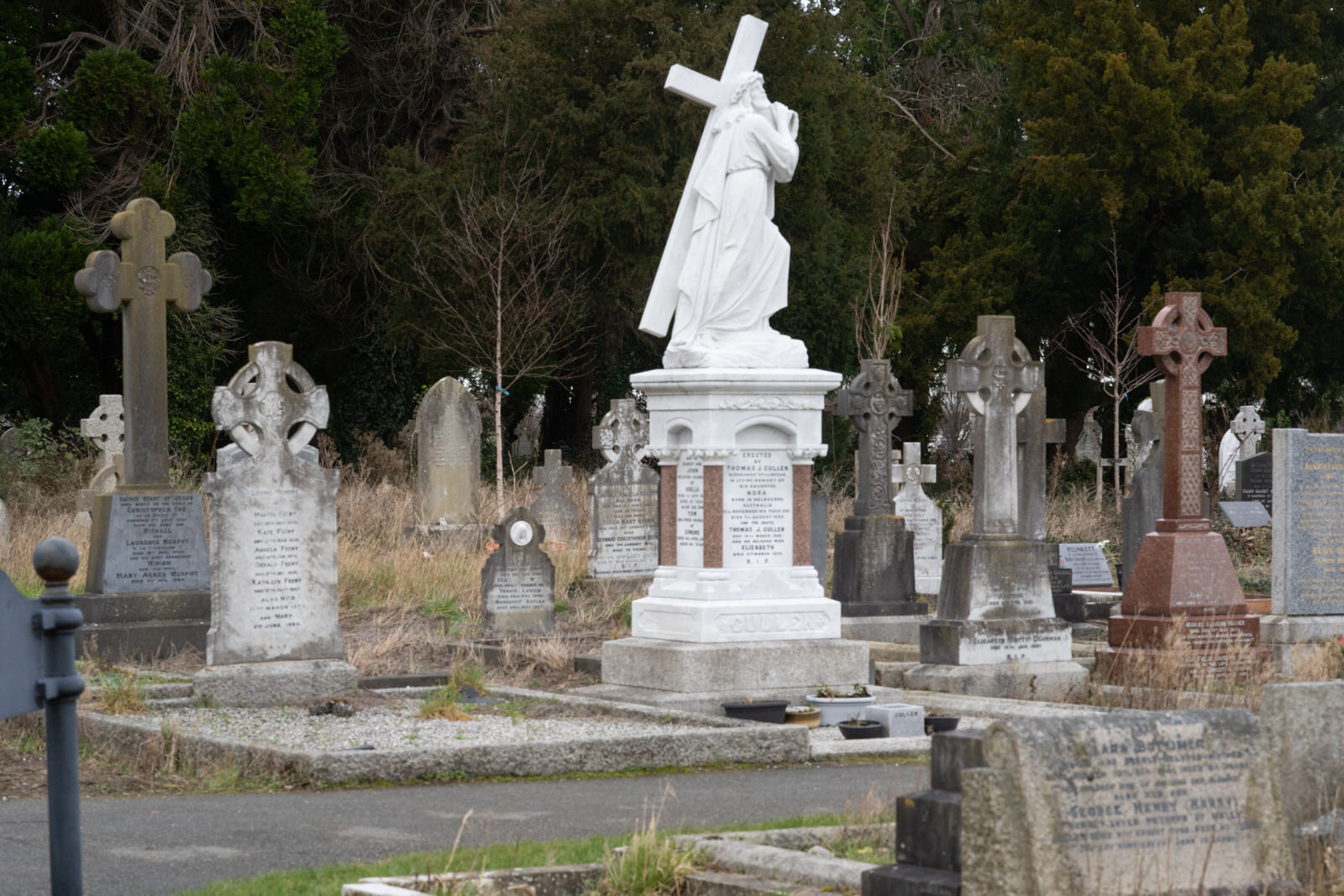
Deansgrange Cemetery
Urban Cartographer on Wednesday, 31st December
I had not planned to visit Deansgrange Cemetery so the lens that I had with me was not really suitable combined with the FX30 and the images proved to be disappointing. I also took some photographs using a iPhone and I will publish them later.
Discovering Ani Mollereau: From Sculpture in Context to the Butler Gallery.
The Urban Cartographer on Friday, 6th March
A retrospective look at the "Hare" sculptures by Irish artist Ani Mollereau. Comparing the stainless steel "Hare 2020" at Kilkenny’s Butler Gallery with the 2016 "Sculpture in Context" exhibit in Dublin, this piece explores the artist’s unique ability to capture animal spirit through dynamic form.
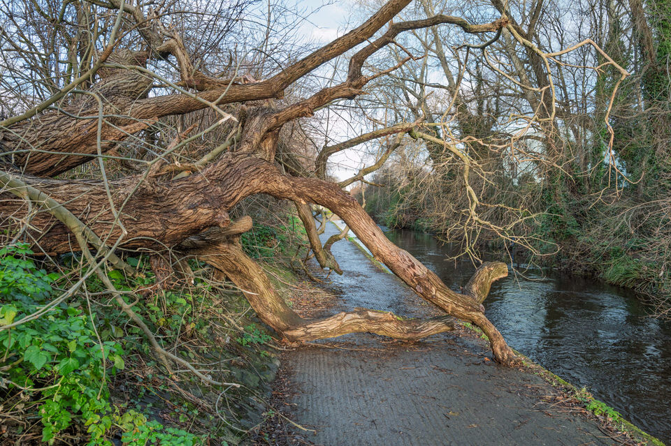
Donnybrook Greenway And Uprooted Trees
Urban Cartographer on Sunday, 18th January
Recent storm damage along the Donnybrook Greenway has left several trees uprooted and submerged in the River Dodder. This follows a series of severe weather events in late 2025 and January 2026, including Storm Claudia and Storm Darragh, which brought high winds and flooding to the Ballsbridge and Donnybrook areas.

Dorset Street And Bolton Street
Urban Cartographer on Sunday, 11th January
Discover the transformation of Dublin 1 with the massive Dorset Street & St. Mary's Place Regeneration and the new Bolton Hotel. Read about the history of the 1963 Bolton Street collapse, the 163 new NZEB social homes, and how the area is being reshaped in 2026.
Double Down Sculpture
The Urban Cartographer on Monday, 16th March
A correction of a previous misidentification of the outdoor sculpture at Butler Gallery, Kilkenny. Following an annual verification visit, I discovered that Isabel Nolan’s "Double Down" (2023) was incorrectly attributed to Phillip King. Read the full story behind the correction here.
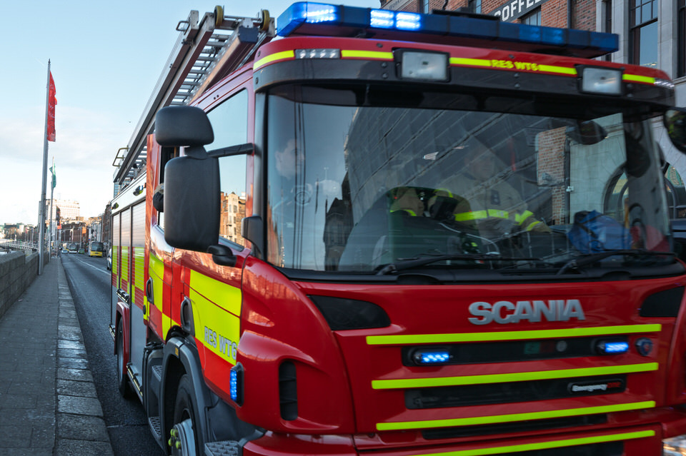
Dublin Fire Brigade
Urban Cartographer on Saturday, 3rd January
Discover the unique history and operations of the Dublin Fire Brigade. Learn how this dual-role service combines firefighting with advanced paramedic care to protect Ireland's capital city, from the 1916 Rising to modern marine rescue.
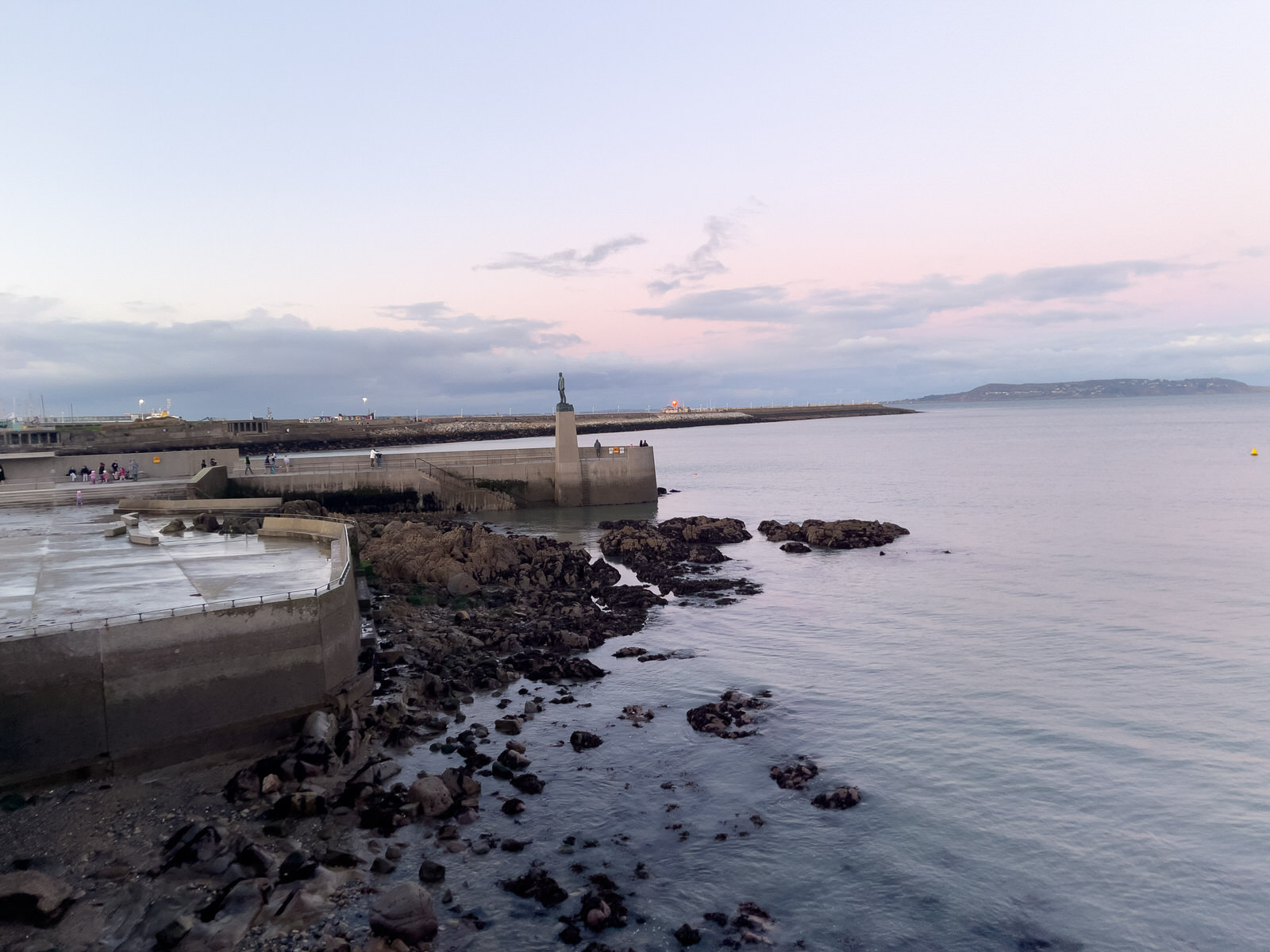
Dun Laoghaire Baths New Year 2025
Urban Cartographer on Wednesday, 31st December
This blog post explores the captivating history of Dun Laoghaire Baths, nestled in the picturesque seaside town of Dun Laoghaire, County Dublin, Ireland. Constructed in 1843 by a private company, the baths were initially intended to provide both fresh and saltwater swimming experiences for the affluent residents of Kingstown, now known as Dun Laoghaire. Over the years, these baths have undergone numerous renovations and transformations, reflecting the changing social and recreational landscape of the town.
Dyke Road Has Changed Since 2019
The Urban Cartographer on Saturday, 4th April
Explore the dramatic transformation of Galway's historic Dyke Road. From its origins as a Great Famine relief project to the current Corrib Causeway redevelopment, we look at why the landscape has changed from a wild thicket to a modern construction site in April 2026.
Dyke Road Waterworks The Fuji Session
The Urban Cartographer on Wednesday, 15th April
Explore the history and future of Galway’s Dyke Road, from the 17th-century ruins of Terryland Castle to the Victorian Waterworks. Discover why this riverside landscape currently looks like a "forest fire" zone and what the 2026 redevelopment plans hold for this historic industrial corridor.

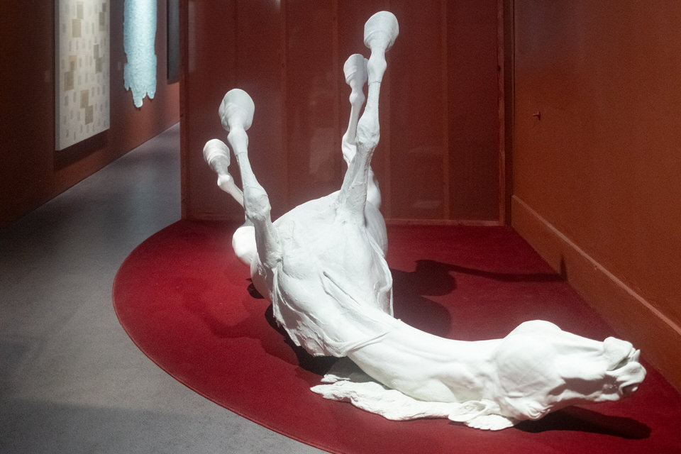
Earthrise By NASA
The Urban Cartographer on Saturday, 11th April
Experience the historic "Earthset" captured by the Artemis II crew in April 2026. This NASA image shows Earth sinking behind the Moon's far side, marking humanity's first crewed return to lunar orbit in over 50 years. Learn about the mission's success and the record-breaking journey of the Orion spacecraft.
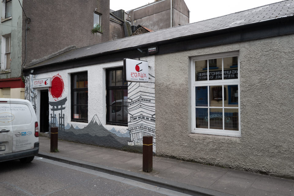
Egawa Sushi 18 Kyle Street Cork
The Urban Cartographer on Wednesday, 13th May
Exploring the rise of the Tucano Group in Ireland and the growing Brazilian influence within Dublin and Cork’s hospitality sectors. From the acquisition of Eatokyo and The Hungry Mexican to the unique regional staffing trends involving Malaysian and Brazilian communities, this post examines the changing face of international dining in Irish cities.
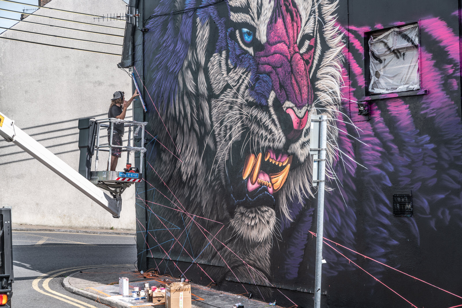
Electric Fury By Sonny Sundancer
The Urban Cartographer on Tuesday, 12th May
The 2016–2017 Waterford Walls festivals marked a pivotal shift in the city's cultural narrative. By reframing derelict walls as canvases for hope, the project successfully reinstated civic pride and repositioned Waterford as a dynamic hub for public art. For the photographer, these remastered images serve as a record of a city in the midst of a profound visual and social reclamation.
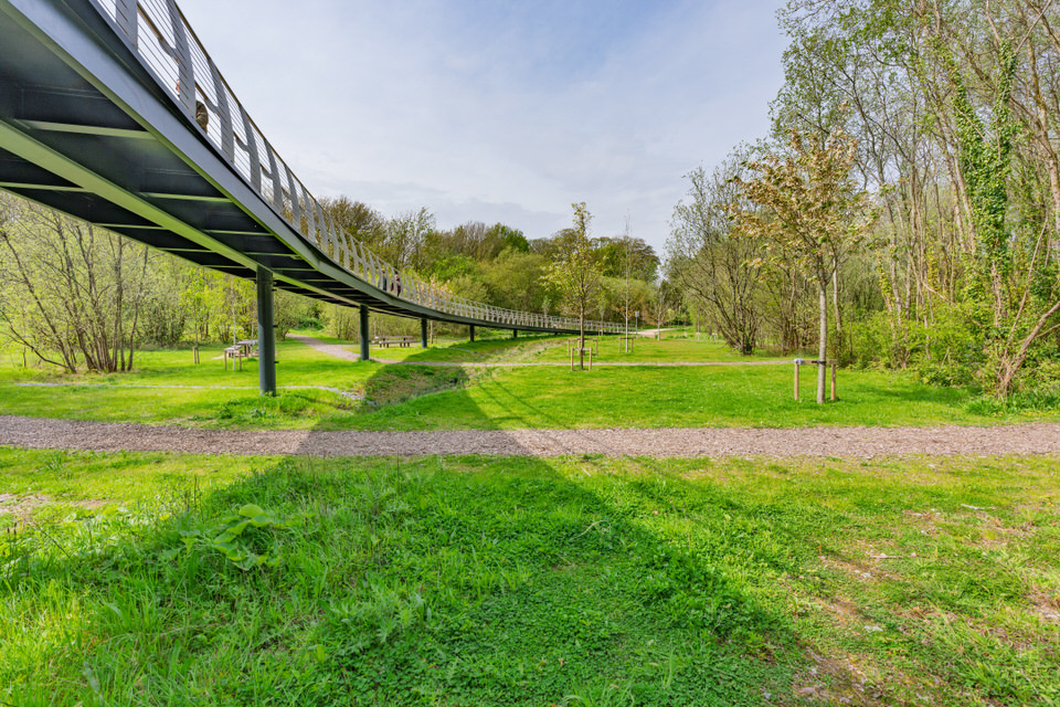
Elevated Tree Walkway In Cork
The Urban Cartographer on Thursday, 30th April
Discover the Elevated Tree Walkway in Cork’s Marina Park. Built by Ward and Burke and designed by OCSC, this Phase 2 development transformed the old Munster Agricultural Showgrounds into a world-class eco-park. Learn about its 2025 completion, the history of Barrington's Folly, and the public's reaction to this new canopy-level promenade.
Equality Emerging By John Behan
The Urban Cartographer on Monday, 23rd March
Discover the history and meaning behind "Equality Emerging," the iconic John Behan sculpture located near Galway Cathedral. Commissioned by Equal Ireland, this bronze masterpiece symbolises the human struggle to break through barriers of inequality. Learn about the artist, the materials used, and why this monument remains a vital part of Galway’s cultural landscape.
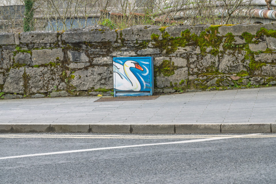
Examples Of Galway Paint A Box Street Art
The Urban Cartographer on Friday, 10th April
Galway’s streets have transformed since 2019. Discover how the "Paint-a-Box" initiative has turned over 100 utility cabinets into vibrant miniature canvases. From Tracey Moca’s whimsical designs to maritime tributes, explore the best of Galway’s street art revolution in this photographic guide.
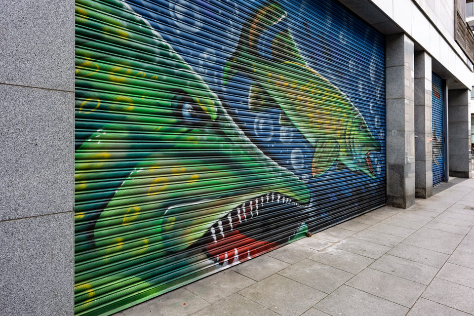
Examples Of Paint A Shutter Street Art
The Urban Cartographer on Monday, 9th March
Explore a dedicated street photography collection documenting the vibrant rise of shutter murals in Dublin. From commissioned hardware shop art to independent graffiti, this archive captures the temporary beauty of the city’s after-hours galleries and the intersection of local business and urban creativity.
Exploring Monahan Road In Cork City
The Urban Cartographer on Monday, 18th May
Exploring The Line Path In Galway
The Urban Cartographer on Tuesday, 7th April
Discover a different side of the City of Tribes beyond the colourful Shop Street. "The Line" in Galway—a narrow pedestrian path running parallel to the Dublin–Galway railway—is a masterclass in urban geometry and cinematic leading lines. Stretching from Eyre Square toward the shimmering waters of Lough Atalia, this industrial artery offers street photographers a unique blend of raw limestone textures, dramatic high-contrast lighting, and authentic local vignettes.
Exploring The Stormont Estate March 2019
The Urban Cartographer on Friday, 13th March
Discover the transformation of the Stormont Estate in Belfast from March 2019 to 2026. This guide covers the iconic Gleaner and Reconciliation sculptures, the remodelled Peace Garden referencing Coventry and Hiroshima, and new memorials including the 2026 Historical Institutional Abuse monument. Learn how the estate’s nature trails and grounds served as a vital community sanctuary during the Covid-19 years.
Ferry Walk Murals April 2026
The Urban Cartographer on Saturday, 25th April
Explore the history of Cork’s Ferry Walk, from the 19th-century Dooley’s Ferry to the iconic Shakey Bridge. This updated 2026 report examines the evolution of its famous graffiti gallery and the current state of street art along the River Lee.
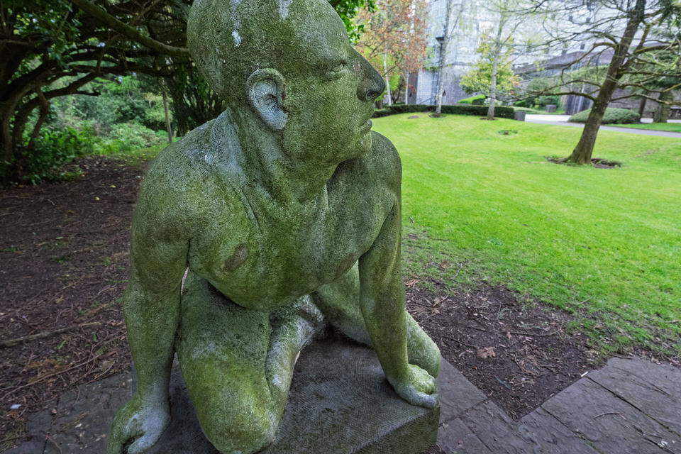
Figure Talking to a Quadruped At UCC
The Urban Cartographer on Saturday, 25th April
Discover the silent dialogue of "Figure Talking to a Quadruped," a captivating 1994 sculpture by renowned Irish artist Michael Quane RHA. Located in the historic President's Garden at University College Cork (UCC), this masterpiece is a highlight of the university’s public art collection. Carved from ancient Kilkenny limestone using the traditional "direct carving" method, the work explores the primal, non-heroic connection between humans and nature. Its raw texture and intentional ambiguity invite visitors to reflect on the tension and communication that exists beyond words. Whether you are an art enthusiast or a visitor to the Cork campus, this iconic piece offers a profound encounter with modern Irish stone carving and the mythic themes of Michael Quane's celebrated career.
Fin Barres Cathedral Leica Q3 Session
The Urban Cartographer on Saturday, 16th May
Discover the hidden treasures within the historic grounds of St. Fin Barre’s Cathedral in Cork. This detailed guide explores the outdoor architecture, ancient graves, and the hidden statue of the begging monk surrounding William Burges’s masterwork.
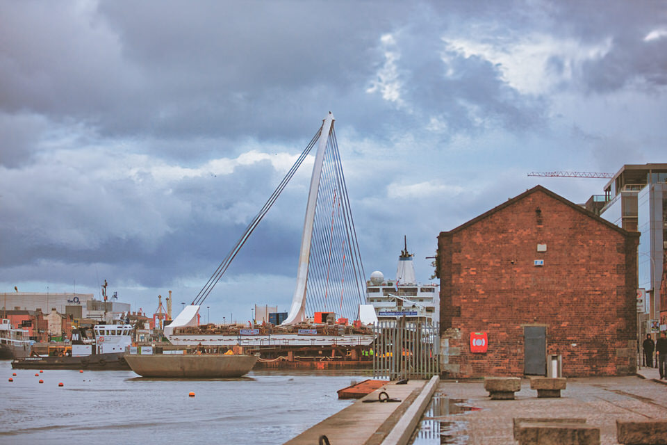
Final Construction Phase Of The Samuel Beckett Bridge
Urban Cartographer on Saturday, 21st February
In May 2009, the Samuel Beckett Bridge completed its 628-mile journey from Rotterdam to Dublin. Transported as a single 2,500-tonne assembly on a sea-going barge, the Santiago Calatrava-designed structure was installed using tidal synchronisation and specialised crawler cranes, marking a pivotal moment in Dublin's Docklands regeneration.
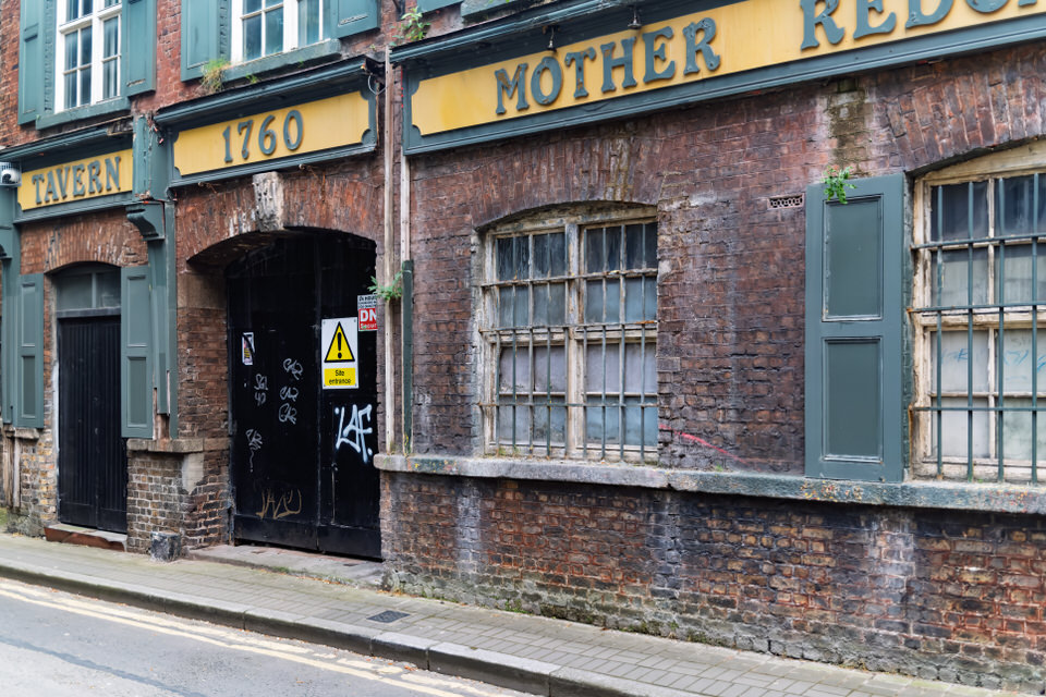
Follow Up Visit To Mother Redcaps May 2026
The Urban Cartographer on Wednesday, 6th May
An updated look at the dereliction of Mother Redcaps Tavern Market in Dublin's Liberties as of April 2026. This report explores the transition from the Winstanley Shoe Factory to a cultural hub, the current legal stalemates preventing redevelopment, and the site's immense archaeological significance near the medieval city walls.
Fountain At Bishop Lucey Park July 2016
The Urban Cartographer on Wednesday, 29th April
the Swan Fountain at Bishop Lucey Park, Cork. Explore the history and artistry of John Behan’s iconic bronze sculpture, commissioned to celebrate Cork’s 800th anniversary. Nestled in the heart of the city between Grand Parade and South Main Street, the newly redeveloped Bishop Lucey Park features restored public art, ancient medieval walls, and modern urban design. Whether you're a history buff or looking for a peaceful city escape, learn why this landmark remains a central pillar of Cork’s cultural heritage.
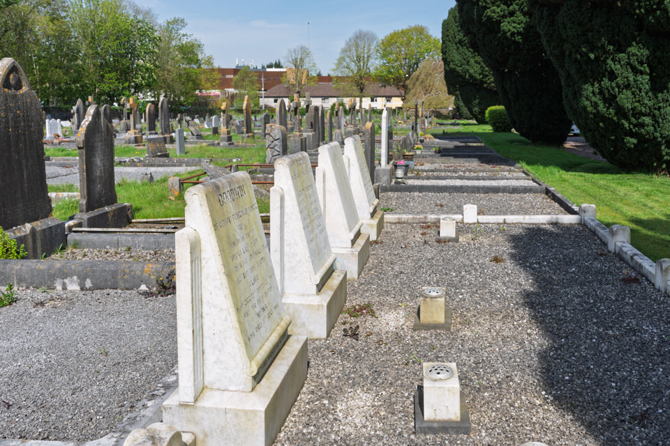
Four Graves At St Lukes In Douglas
The Urban Cartographer on Wednesday, 29th April
Explore the unique communal burial plots of the Goodwin, Veitch, and Waugh families at St Luke’s Graveyard, Douglas. Discover the meaning behind the row’s uniform "Open Book" monuments, the mystery of the blank reserve stone, and how these 20th-century graves reflect the Protestant industrial heritage of Cork.
Fr Mathew Quay In Cork City Centre
The Urban Cartographer on Friday, 15th May
Explore the history, architectural importance, and modern transformation of Father Mathew Quay in Cork City. Discover its industrial legacy, the derelict 19th-century corn store at numbers 4 and 5, landmarks like the Holy Trinity Church and RTÉ studios, and the major ongoing Morrison's Island flood defence and public realm engineering works changing the face of the River Lee waterfront
Francis Street 8 March 2026
The Urban Cartographer on Sunday, 8th March
Discover the complex history and recent upgrading of Francis Street in Dublin’s Liberties. From the long-awaited restoration of the Iveagh Market to the rebuilding of Drop Dead Twice following a devastating fire, explore the evolution of Dublin’s premier antiques district into a modern urban boulevard.
From Asylum to Academy - Dublin's New Education Giant
Urban Cartographer on Thursday, 15th January
Discover how the TU Dublin Grangegorman campus is transforming Dublin 7 into a university quarter rivalling the scale of Queen's Belfast. We explore the "factory" culture trap, the heavy machinery keeping Bolton Street open, and the ironic twist of Dublin City Council moving to the old Kevin Street site.

Fuji X100Vi
William Murphy on Thursday, 13th November
Galway Streets Session One
The Urban Cartographer on Saturday, 11th April
Discover the unique blend of commercial vibrancy and residential charm in Galway’s Eyre Street area. Nestled between Eyre Square and the historic Woodquay district, this neighbourhood features premier shopping on Bóthar na mBan and quaint, modernised living on St Brendan’s Avenue. Whether you are seeking the best of Galway’s retail scene or a quiet city-centre retreat, this versatile area offers the perfect base to experience the authentic culture and convenience of the City of the Tribes.
Glasnevin Cemetery As It Was In 2018
The Urban Cartographer on Saturday, 28th March
Discover why Glasnevin Cemetery is one of Dublin’s top-rated tourist attractions. From the resting place of Michael Collins to the stunning O’Connell Tower, explore the rich history and architectural beauty of Ireland’s most famous necropolis.
Glasnevin Cemetery Saturday 7 March 2026
The Urban Cartographer on Saturday, 7th March
Discover Glasnevin Cemetery, Ireland’s National Cemetery and the final resting place of 1.5 million souls. Explore the graves of Michael Collins and Daniel O’Connell, climb the iconic O’Connell Tower, and delve into 200 years of Irish history through award-winning museum exhibits and guided tours in the heart of Dublin.
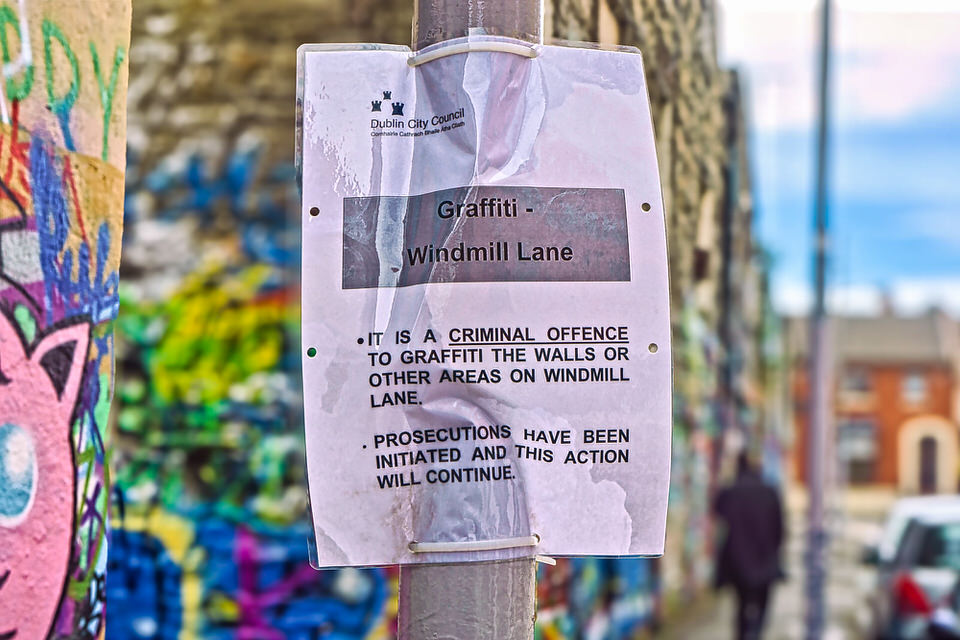
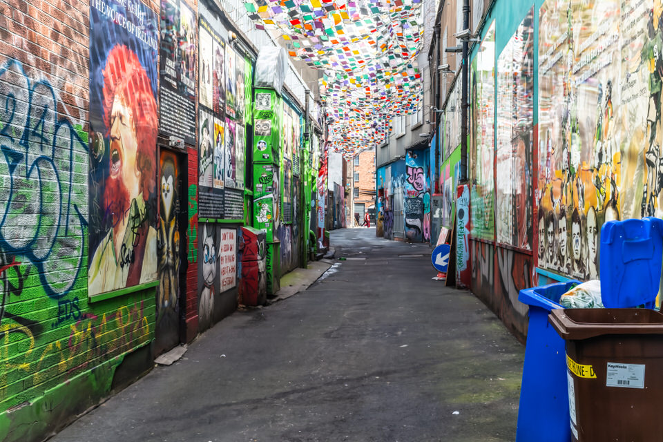
Graffiti Is Illegal In Ireland
The Urban Cartographer on Tuesday, 5th May
Explore the history and demolition of Dublin's famous U2 graffiti wall at Windmill Lane, the evolution of Irish graffiti legislation, and how community art initiatives like Dublin Canvas are transforming the urban landscape.
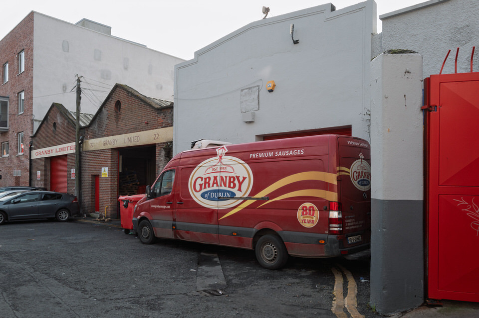
Granby Lane And Granby Place
Urban Cartographer on Monday, 12th January
Explore the history of Granby Lane and Granby Place in Dublin 1. Connecting Lower Dominick Street to Granby Row, this area has transformed from a notorious "rough" spot to a functional industrial hub. It is notably the home of the iconic Granby Sausages distribution complex, a staple of Dublin food culture since 1933. Discover the gritty history and commercial resilience of this North Inner City laneway.
Granby Row And Parnell Square North
Urban Cartographer on Monday, 12th January
Updates on the Parnell Square Cultural Quarter and the restoration of No. 28 Granby Row. Discover the history of Granby Sausages and the Plaza Cinema, the recent completion of the Findlater Church renovation, and plans for the Miami Showband Memorial relocation.
Grangegorman Lower 22 February 2026
Urban Cartographer on Sunday, 22nd February
Discover how Grangegorman is being transformed from an institutional stronghold into a vibrant "University City." This article explores the impact of the TU Dublin campus on Dublin 7, detailing the massive infrastructure shifts, the preservation of historic architecture, and the evolving relationship between the university and the local communities of Stoneybatter and Phibsborough.
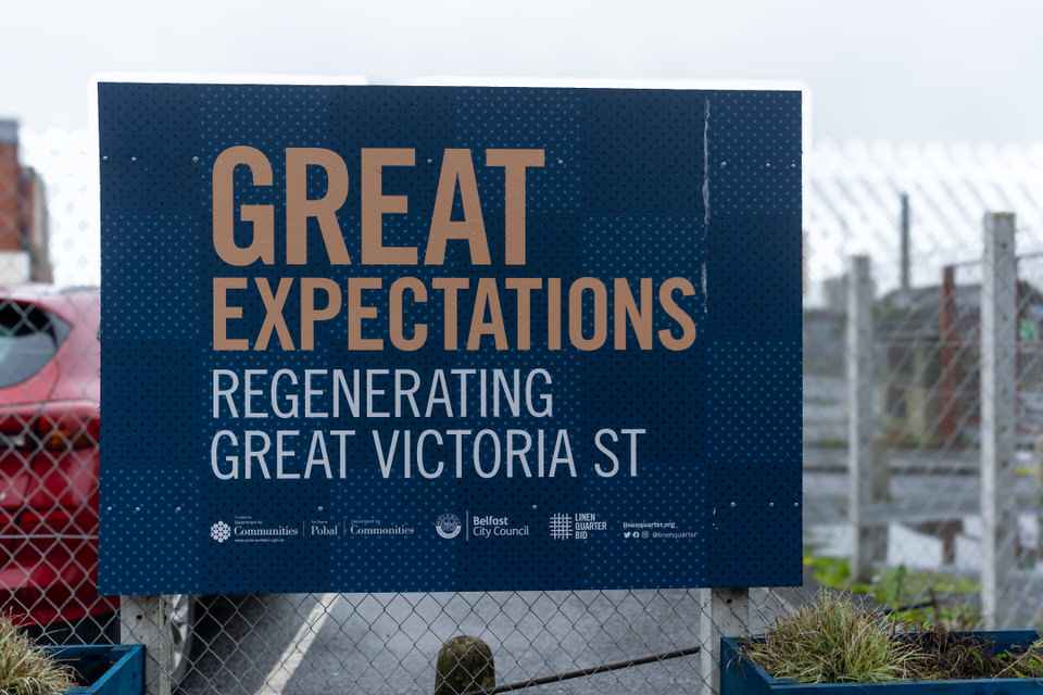
Great Expectations Poster Campaign
Urban Cartographer on Thursday, 5th February
The "Great Expectations" campaign in Belfast is a strategic regeneration project by the Linen Quarter BID to revitalise Great Victoria Street. Aimed at supporting the new £340m Belfast Grand Central Station and Weavers Cross development, the campaign uses murals and streetscape enhancements to restore the historic "Golden Mile." This initiative addresses urban dereliction while connecting the modern transport hub with local communities like Sandy Row.
Griffith Avenue Mobhi Road To Swords Road
The Urban Cartographer on Tuesday, 5th May
A photographic and historical exploration of Griffith Avenue and Glasnevin, Dublin. Discover the origins of St Mobhí Road, the legacy of Jonathan Swift, and the architectural beauty of Europe’s longest tree-lined residential avenue, captured through the classic lens of a Canon 5D Mark III.
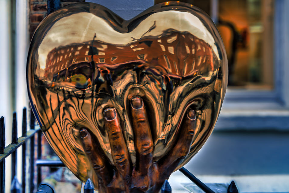
Heart In Hand By Patrick O'Reilly
Urban Cartographer on Friday, 13th February
Explore the evolution of Patrick O’Reilly’s iconic heart sculptures in Dublin. From the polished vulnerability of Heart in Hand on South Frederick Street to the soaring red "sails" of Heartfelt on Burlington Road, discover how O'Reilly has transformed the city's landscape, replacing the mythological power of Queen Maeve with modern symbols of renewal and resilience.
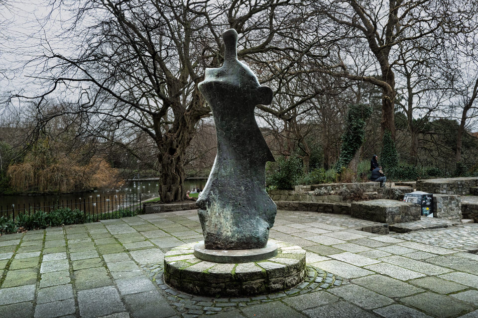
Henry Moore Sculpture
Urban Cartographer on Sunday, 15th February
Explore the history and artistry of Henry Moore’s "Knife Edge," the iconic abstract memorial to W.B. Yeats in St Stephen’s Green, Dublin. Discover how this bronze masterpiece blends Irish literary legacy with 20th-century modernist sculpture.
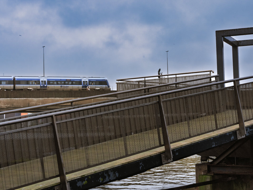
Hibernian Road And Pedestrian Bridge
The Urban Cartographer on Friday, 1st May
Explore the industrial history of Hibernian Road in Cork City, from its 19th-century railway terminus to the iconic white pedestrian bridge spanning the South Link Road. Discover how this vital infrastructure preserves pedestrian access in a changing urban landscape.
Historic Cork South Side April 2026
The Urban Cartographer on Sunday, 17th May
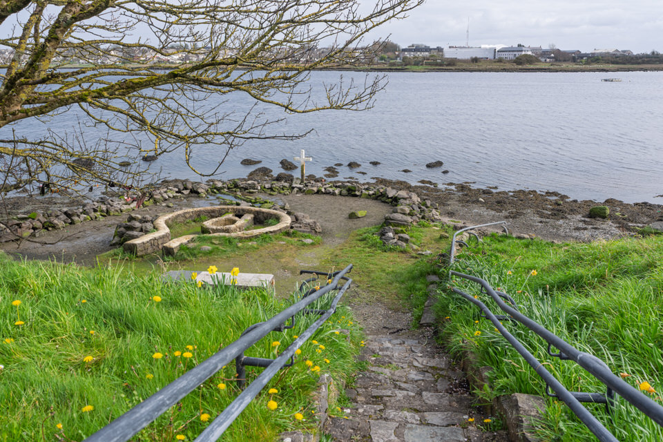
Holy Well Galway April 2026
The Urban Cartographer on Sunday, 5th April
Discover the unique St Augustine’s Holy Well on the shores of Lough Atalia, Galway. A rare example of a tidal sacred spring restored by the Galway Civic Trust, this site is steeped in local folklore and famous for its traditional healing powers. Learn about its history, the 2000 renovation, and tips for visiting this coastal landmark.

{{item.title}}
{{item.author.name}} on {{item.date_published|date("l, jS F")}}
{{item.extract}}