Atalia Road In Galway April 2026 - Presented By The The Urban Cartographer
LET MISTER SCREEN ASSIST YOU
GLOBAL INDEXThe Urban Cartographer
TECHNICAL STUFFExplore the unique history and social fabric of Lough Atalia Road in Galway. From the private shoreline gardens and affluent residential mix to the industrial heritage of the Galway Docks and the historic Forthill Graveyard, discover the story of one of the West of Ireland’s most scenic and historic coastal routes.
EXCELLENT PICTURE THIS 2017
Atalia Road In Galway April 2026 - Presented By The The Urban Cartographer
Atalia Road In Galway April 2026
Author: The Urban Cartographer
|
06. Apr 2026
 Lough Atalia Road - Select Image To View Photographs
Lough Atalia Road is one of Galway City’s most distinctive thoroughfares, serving as a scenic arterial route that skirts the northern shore of the Lough Atalia inlet. Acting as a vital bridge between the industrial grit of the docks and the residential tranquility of Renmore, the road offers a unique cross-section of Galway’s evolution from a medieval stronghold to a modern maritime hub.
History and Tradition
Historical Origins and the Railway Influence
Originally, the area was a wide tidal inlet of Galway Bay. The modern character of the road was fundamentally shaped by the arrival of the Midland Great Western Railway in the mid-19th century. The construction of the massive railway embankment restricted the natural flow of the tide, effectively creating the "lough" as a semi-enclosed salt lake.
Historically, the road served the functional periphery of the city, but as Galway expanded eastward, it transformed into a premier residential location, prized for its south-facing aspect and unobstructed water views.
The Residential Profile: A Unique Property Layout
The residential stretch of Lough Atalia Road features a blend of mid-20th-century semi-detached houses and substantial, older detached residences. The demographic is largely professional and well-established, making it a "mature" area where properties are highly coveted and rarely reach the open market.
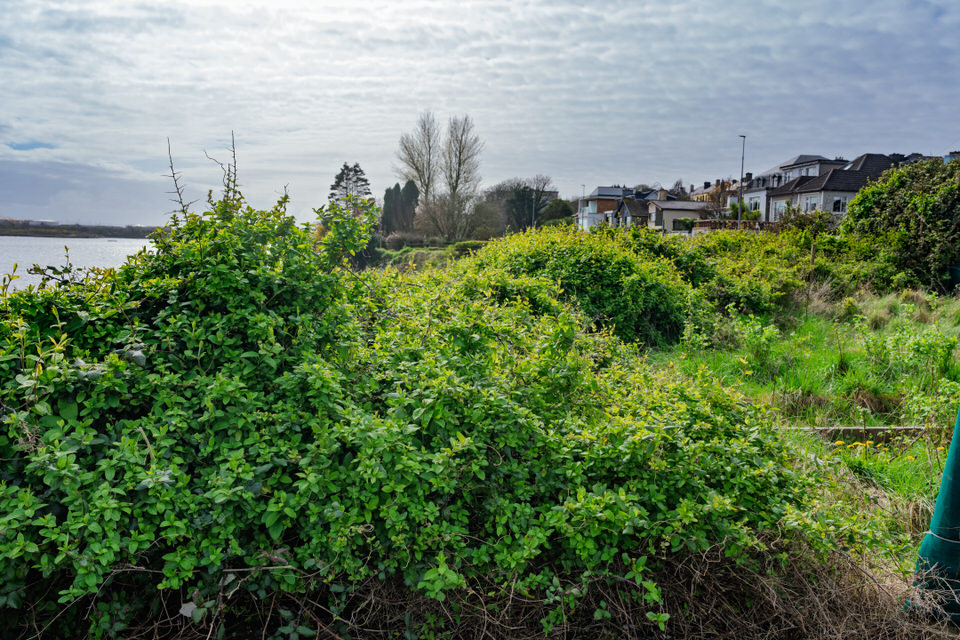
The "Across the Road" Gardens
One of the most curious features of the road is the strip of green space situated between the pavement and the water’s edge.
Ownership: In a rare legal arrangement, many homeowners on the landward side hold the deeds to the narrow slips of garden on the seaward side of the road.
Usage: These "disconnected" gardens often feature private seating areas, boat launches, or small sheds. While the shoreline remains accessible in parts, these tiered gardens are private property, creating a layout where a public road bisects a private domestic holding.
The Industrial Heart: The Galway Docks
As the road travels west toward the city centre, the atmosphere shifts abruptly at the industrial terminus. This section is dominated by the Galway Docks, defined by heavy commercial traffic, oil storage tanks, and timber yards.
This area represents the city's commercial lungs, though it is currently at the centre of long-standing redevelopment discussions. Future "masterplans" suggest a potential shift of heavy industry further afield to allow for a modern waterfront district featuring apartments, offices, and leisure spaces.
Forthill Graveyard: A Site of Execution and Remembrance
At the western terminus where Lough Atalia Road meets the city, lies Forthill Graveyard. Though it may not appear significantly elevated today, it was historically an elevated limestone outcrop known as St Augustine’s Hill.
The Evolution of the "Hill"
The site's elevation was masked in the 19th century when the surrounding ground level was raised during the construction of the railway and modern road networks. However, the graveyard still sits within the footprint of a star-shaped fort (St Augustine’s Fort) established by the English in 1602. The sturdy boundary walls visible from the road today actually incorporate the original 17th-century fortifications.
The Spanish Armada Connection
Forthill is the site of one of the most somber events in Galway's history. In September 1588, following the wreck of the Spanish Armada along the Irish coast, approximately 300 Spanish survivors were brought to Galway as prisoners. Under the orders of Sir Richard Bingham, the Governor of Connacht, they were taken to this hill and executed. Today, two modern monuments within the grounds—unveiled in 1988—commemorate these sailors in Spanish and Irish.
Cultural Heritage
The graveyard is also noted for:
Augustinian Roots: It was originally the site of a 15th-century friary, and remarkably, the site remains the property of the Augustinian Order today.
Vocational Headstones: Visitors can find 18th-century stones carved with the symbols of the deceased's trade, including blacksmith’s anvils, weaver’s shears, and mason’s trowels.
Modern Status
Today, Lough Atalia Road is a vital yet congested transport link, famous locally for its low railway bridge which frequently challenges unsuspecting lorry drivers. It remains a place of stark contrasts—where private garden retreats sit mere metres from heavy industrial shipping, and where the echoes of the Spanish Armada linger beside the busy commute into the heart of the "City of the Tribes."
 The Holy Well - Select Image To View Photographs
VIEW HI-RES PHOTOGRAPHS
CORK CITY AND COUNTY
ABOUT ATALIA ROAD
GLOBAL INDEX OF PHOTO GALLERIES
GALWAY CITY
THE URBAN CARTOGRAPHER
EXCELLENT PICTURE THIS 2017
Atalia Road In Galway April 2026 - Presented By The The Urban Cartographer
Who Is Building An Experience Which Is Getting Better Day By Day