Viking Area Of Dublin - Presented By The Urban Cartographer
LET MISTER SCREEN ASSIST YOU
GLOBAL INDEXThe Urban Cartographer
TECHNICAL STUFFExplore the history of Dublin’s Oxmantown, from Viking street names and secret "OAP" gardens to the controversial impact of the O'Devaney Gardens redevelopment on historic artisan cottages.
EXCELLENT PICTURE THIS 2017
Viking Area Of Dublin - Presented By The Urban Cartographer
Viking Area Of Dublin
Author: Urban Cartographer
|
16. Jan 2026
Photographed By William Murphy
Stoneybatter is widely regarded as one of Dublin's most characterful neighbourhoods, a "village within the city" famed for its red-brick terraces and artisan dwellings. Yet, beneath the Victorian architecture lies a much older heritage, and rising above it is a contentious modern future. The district surrounding Thor Place stands on the footprint of Oxmantown, the final stronghold of Dublin’s Vikings. Walking through these streets today reveals a fascinating layering of history: ancient Norse echoes enshrined in street names, the intimate social history of hidden green spaces, and the looming impact of the O'Devaney Gardens redevelopment. The history of this enclave began in conflict. Following the Anglo-Norman capture of Dublin in 1170, the city’s Hiberno-Norse population—known as the "Ostmen" or Men of the East—was expelled from the walled citadel. Displaced but not defeated, they crossed the River Liffey and established a new settlement on the north bank. This settlement became Ostmanby (Oxmantown), a distinct suburb that maintained its own customs and autonomy for centuries. While the wooden longhouses of that era have vanished, the geography of the Viking settlement aligns closely with modern-day Stoneybatter and Smithfield.
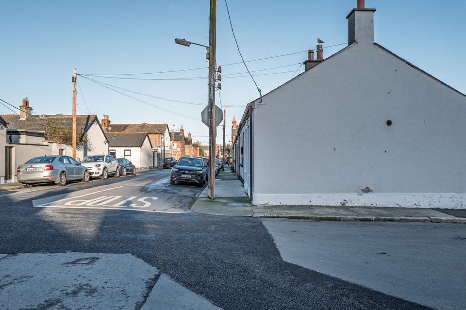
Thor Place: Named for the Norse god of thunder. Sitric Road: A tribute to the Norse Kings of Dublin. Olaf & Viking Roads: Direct references to the Scandinavian settlers. Hidden Sanctuaries: Thor Place and Halliday Square Amidst these historic names lie unique social experiments in urban living. The green space at the centre of Thor Place offers a glimpse into the tight-knit community spirit of the 20th century. For decades, this gated "pocket park" carried a strict designation: it was reserved exclusively for Old Age Pensioners (OAPs). In a high-density neighbourhood, this rule ensured the community's elders had a peaceful sanctuary, safe from the noise of local children. Nearby, Halliday Square represents the generosity of one resident, James Franey. A baker at Boland’s Mills, Franey purchased this plot to cultivate as an allotment. In 1997, rather than selling the land for development, he donated it to the Dublin Corporation. Today, it stands as a communal lung for the street, a permanent legacy of a baker who wanted to leave his neighbourhood greener than he found it. However, the character of this historic Viking enclave faces a new and dramatic challenge. The area has historically been defined by its low-rise, human-scale architecture—rows of single-storey, red-brick artisan cottages that have stood for generations. This aesthetic is now being starkly contrasted by the massive redevelopment of O'Devaney Gardens. The new concrete and steel towers rising immediately behind the delicate Victorian streets have introduced a vertical disparity that many residents find jarring. The Canyon Effect: The sheer scale of the new apartment blocks dwarfs the existing single-storey homes, creating what locals describe as a "canyon effect." Loss of Light: Streets like Thor Place, which previously enjoyed open skies and natural light, now face the prospect of long shadows cast by the high-rise structures. This juxtaposition creates a visual friction between the two eras of Dublin. The artisan cottages, built to house the workers of a bustling industrial city, represented a modest, community-focused approach to urban living. The looming towers of the new O'Devaney Gardens represent a modern drive for density, physically overshadowing the "village" feel that has defined Stoneybatter for over a century. From the exiled "Ostmen" establishing a new life across the river to the pensioners of Thor Place, and now the residents living in the shadow of new developments, this pocket of Dublin 7 is defined by resilience. It is a place where history is not just found in books, but is written on the street signs, planted in the gardens, and contested in the changing skyline.Select Image To Visit The Photo Gallery: Viking Area Of Dublin

When you view my photographs you may be surprised to see the scale of the O'Devaney Gardens and its impact especially on Thor Place.
The Victorian and Edwardian town planners who built the current housing stock chose to honour this lineage through street names, creating a permanent "Viking Network" in stone and brick:
GALWAY CITY
CORK CITY AND COUNTY
GLOBAL MENU
DUBLIN SOUTHSIDE
DUBLIN NORTHSIDE
URBAN CARTOGRAPHER
EXCELLENT PICTURE THIS 2017
Viking Area Of Dublin - Presented By The Urban Cartographer
Who Is Building An Experience Which Is Getting Better Day By Day