Salthill Shore And Intertidal Areas - Presented By The The Urban Cartographer
LET MISTER SCREEN ASSIST YOU
GLOBAL INDEXThe Urban Cartographer
TECHNICAL STUFFDiscover the rugged coastal beauty of Salthill, Galway. This guide explores the diverse shoreline, including the iconic Blackrock Diving Tower, the sandy stretches of Ladies Beach, and the natural rock pools formed by ancient geological outcrops. Learn about the slipways, piers, and intertidal zones that make Salthill a premier destination for open-water swimmers and nature enthusiasts on Ireland's west coast.
EXCELLENT PICTURE THIS 2017
Salthill Shore And Intertidal Areas - Presented By The The Urban Cartographer
Salthill Shore And Intertidal Areas
Author: The Urban Cartographer
|
08. Apr 2026
 THe Shore Area - Select Image To View Photographs
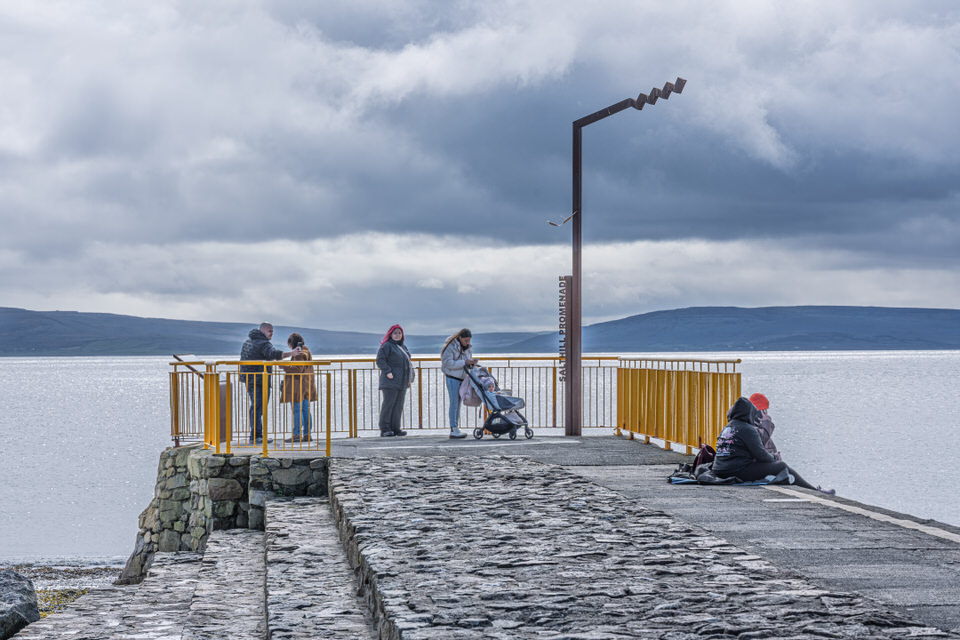
The shore area of Salthill, Galway, is a rugged and varied landscape where the limestone of the Burren across the water meets the dark, igneous outcrops of the Atlantic coast. Moving away from the paved walkways, the shoreline reveals a complex network of natural and man-made features that define Galway’s relationship with the sea.
The Beaches
The Salthill shore is not a single continuous strand but a series of distinct pockets. These vary from the fine, golden sands of Ladies Beach and Salthill Beach to more secluded, shingled coves.
Ladies Beach: Historically named for its 19th-century gender segregation, it is now the largest sandy stretch and a primary hub for families.
Geological Outcrops: The beaches are partitioned by significant rocky "shelves" and outcrops. These provide natural rock pools at low tide, which are rich in marine life like shore crabs, periwinkles, and various seaweeds.
Piers and Landmarks
The most iconic structure along the shore is the Blackrock Diving Tower. Standing at the western terminus, this tiered concrete structure is a temple for year-round swimmers.
Blackrock Pier: The pier and slipways here facilitate the famous "leap" into the Atlantic. At high tide, the tower’s platforms allow for diving into deep, bracing water, while the lower slipways provide easier access for those preferring a gradual entry.
Palmer’s Rock: A notable rocky outcrop often used as a marker by local open-water swimmers venturing out into the bay.
Slipways and Intertidal Zones
The shore is dotted with functional concrete slipways, traditionally used for launching small currachs or rescue boats, but now primarily used by the local swimming community.
Terrain: Between the piers, the ground is a mixture of large erratic boulders and smooth limestone slabs.
The Intertidal Zone: At low tide, the shore expands significantly, exposing vast kelp forests and sandbars. This area is a crucial habitat for wintering birds and a popular spot for "shore safaris" hosted by the nearby aquarium to educate the public on local biodiversity.
 Art Deco Shelters - Select Image To View Photographs
VIEW HI-RES PHOTOGRAPHS
CORK CITY AND COUNTY
ABOUT THE INTERTIDAL AREAS
GLOBAL INDEX OF PHOTO GALLERIES
GALWAY CITY
THE URBAN CARTOGRAPHER
EXCELLENT PICTURE THIS 2017
Salthill Shore And Intertidal Areas - Presented By The The Urban Cartographer
Who Is Building An Experience Which Is Getting Better Day By Day