Kilkenny Cathedral Enclosure And Its Arteries - Presented By The The Urban Cartographer
LET MISTER SCREEN ASSIST YOU
GLOBAL INDEXThe Urban Cartographer
TECHNICAL STUFFExplore the historic laneways of Kilkenny near St Canice’s Cathedral. Discover the medieval "slips" and ancient paths like Vicar Street and Coach Road that define Ireland's Medieval Mile. Learn about the architectural heritage, from 13th-century burgage plots to the hidden history of the Cathedral Close and Irishtown.
EXCELLENT PICTURE THIS 2017
Kilkenny Cathedral Enclosure And Its Arteries - Presented By The The Urban Cartographer
Kilkenny Cathedral Enclosure And Its Arteries
Author: The Urban Cartographer
|
02. May 2026
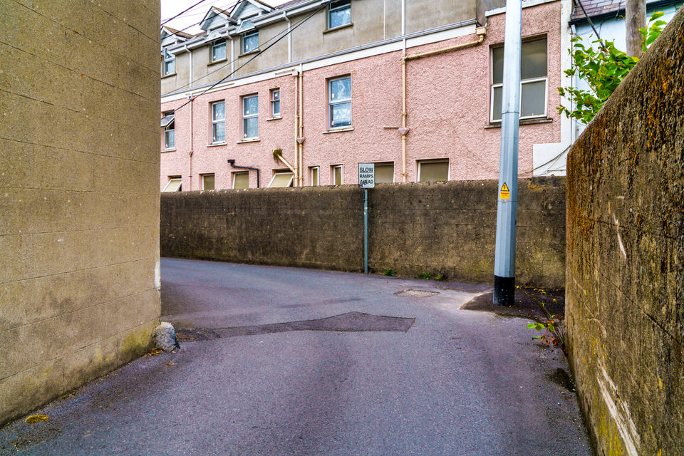
The laneways near the cathedral were designed for both utility and defence. Their narrow, winding configurations made them easily defensible against invaders, while also serving as vital conduits for the transport of goods to the "Irishtown" district (Smithwick's Experience, n.d.). Many of these lanes originated from burgage plots—long, narrow strips of land established in 1207 by William Marshal. These plots required alleyways to provide light and access to the interior of deep buildings, resulting in the dense network of "slips" that characterise the city today (Kilkenny County Council, 2026). If you take a guided tour of Kilkenny this is the network of lanes that you are likely to explore. The Cathedral Enclosure and its Arteries The area surrounding St Canice's Cathedral, known as the Cathedral Close, was historically defined by concentric circular enclosures typical of early medieval monastic foundations (Kilkenny County Council, n.d.). These enclosures dictated the curving street patterns seen today in Vicar Street, St Canice's Place, and Coach Road (Kilkenny County Council, n.d.). Vicar Street: Once home to the Vicars Choral, this street served as a residence for church dignitaries. While many original structures have been modernised, the street still contains remains of 16th-century walls and Tudor-style windows (Phelan & Gibb, 1956). St Canice's Place (Ancient Bull Alley): Originally a narrow path where residents could nearly "shake hands across the roadway," it was widened in the 19th century. It took its name from the Bull Inn, a Tudor-period stone structure whose ruins were a local landmark for centuries (Phelan & Gibb, 1956). Coach Road and Church Lane: These paths provided direct access to the cathedral and the Bishop's Palace. Church Lane is notable for the Sexton’s House (originally the Precentor’s Manse, c. 1640), which features an original round-headed entrance door and nearby 6th-century effigies (Kilkenny County Council, n.d.). Architectural and Strategic Significance The laneways near the cathedral were designed for both utility and defence. Their narrow, winding configurations made them easily defensible against invaders, while also serving as vital conduits for the transport of goods to the "Irishtown" district (Smithwick's Experience, n.d.). Many of these lanes originated from burgage plots—long, narrow strips of land established in 1207 by William Marshal. These plots required alleyways to provide light and access to the interior of deep buildings, resulting in the dense network of "slips" that characterise the city today (Kilkenny County Council, 2026). Sculpture - Select Image To View Photographs Select Image Below To Visit The Photo Gallery: Anchored Void by Michael Warren
 The Laneways - Select Image To View Photographs
 Bishopmeadows - Select Image To View Photographs
 Th River Nore 2026 Visit - Select Image To View Photographs

VIEW HI-RES PHOTOGRAPHS
KILKENNY 2018
ABOUT THE LANEWAYS
GLOBAL INDEX OF PHOTO GALLERIES
BISHOPMEADOWS 2021 VISIT
THE URBAN CARTOGRAPHER
EXCELLENT PICTURE THIS 2017
Kilkenny Cathedral Enclosure And Its Arteries - Presented By The The Urban Cartographer
Who Is Building An Experience Which Is Getting Better Day By Day